4 min read
Preparations for Next Moonwalk Simulations Underway (and Underwater)
Warming global climate is changing the vegetation structure of forests in the far north. It’s a trend that will continue at least through the end of this century, according to NASA researchers. The change in forest structure could absorb more of the greenhouse gas carbon dioxide (CO2) from the atmosphere, or increase permafrost thawing, resulting in the release of ancient carbon. Millions of data points from the Ice, Cloud, and land Elevation Satellite 2 (ICESat-2) and Landsat missions helped inform this latest research, which will be used to refine climate forecasting computer models.
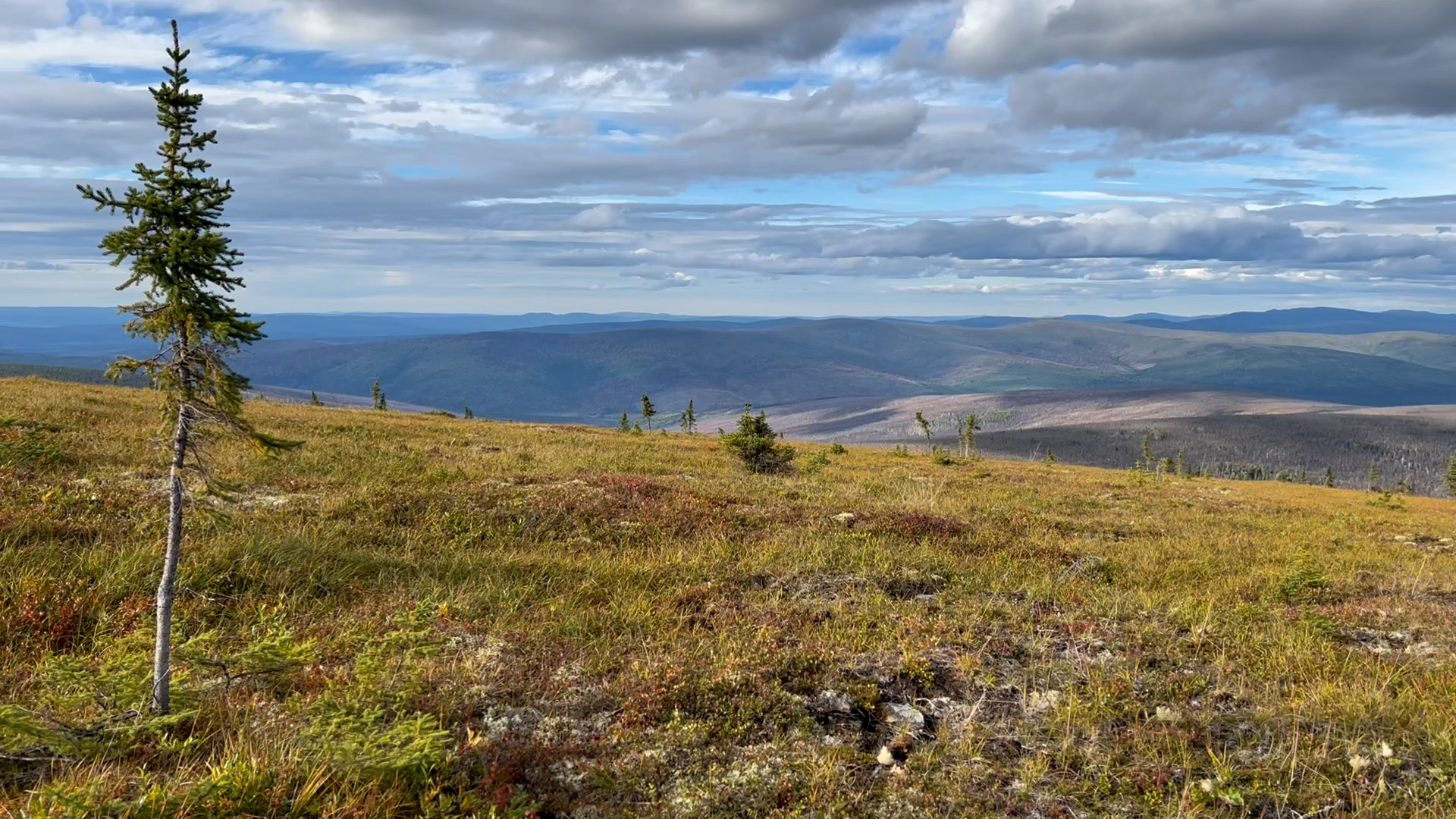
Tundra landscapes are getting taller and greener. With the warming climate, the vegetation of forests in the far north is changing as more trees and shrubs appear. These shifts in the vegetation structure of boreal forests and tundra will continue for at least the next 80 years, according to NASA scientists in a recently published study.
Boreal forests generally grow between 50 and 60 degrees north latitude, covering large parts of Alaska, Canada, Scandinavia, and Russia. The biome is home to evergreens such as pine, spruce, and fir. Farther north, the permafrost and short growing season of the tundra biome have historically made it hard to support large trees or dense forests. The vegetation in those regions has instead been made up of shrubs, mosses, and grasses.
The boundary between the two biomes is difficult to discern. Previous studies have found high-latitude plant growth increasing and moving northward into areas that earlier were sparsely covered in the shrubs and grasses of the tundra. Now, the new NASA-led study finds an increased presence of trees and shrubs in those tundra regions and adjacent transitional forests, where boreal regions and tundra meet. This is predicted to continue until at least the end of the century.
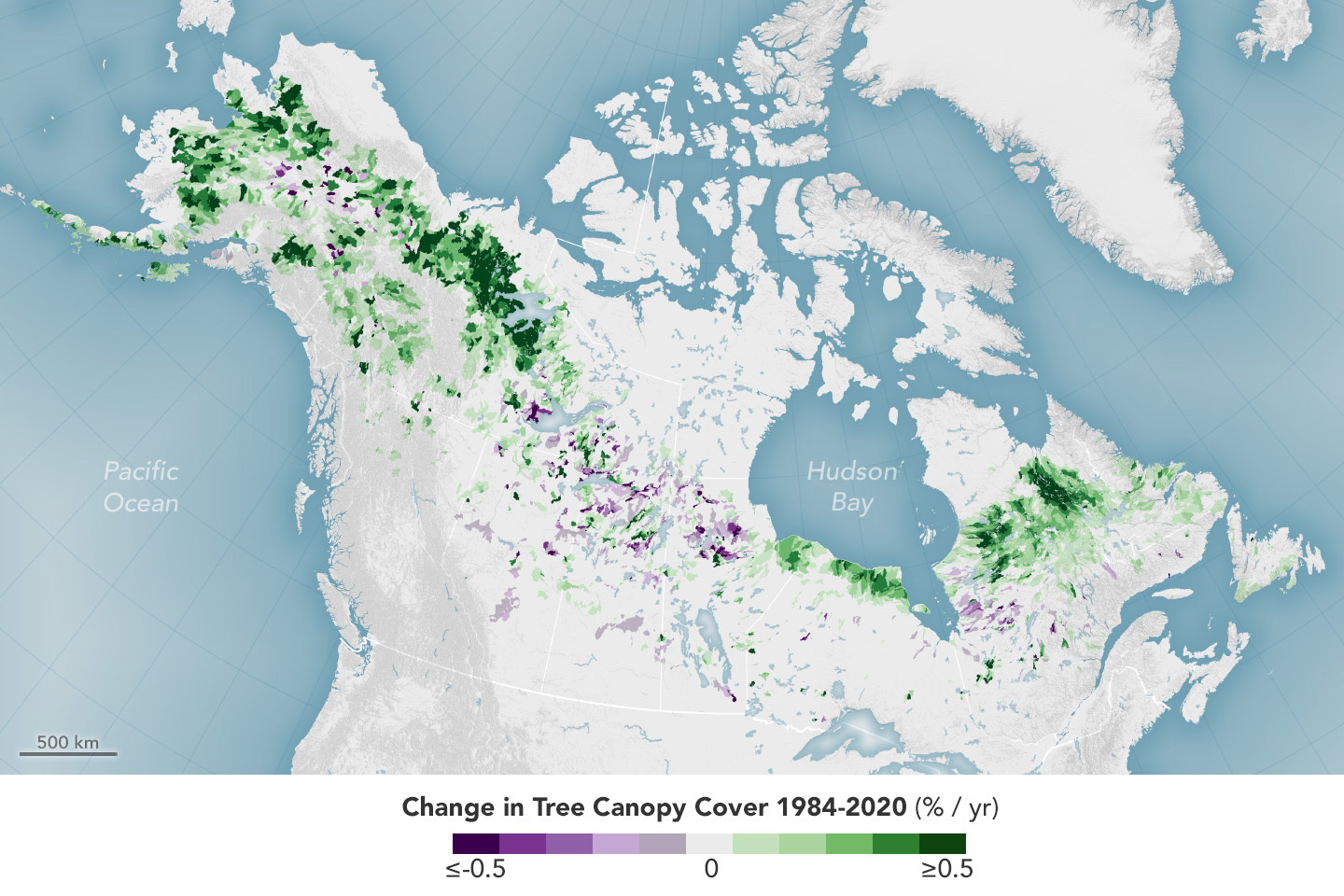
“The results from this study advance a growing body of work that recognizes a shift in vegetation patterns within the boreal forest biome,” said Paul Montesano, lead author for the paper and research scientist at NASA Goddard’s Space Flight Center in Greenbelt, Maryland. “We’ve used satellite data to track the increased vegetation growth in this biome since 1984, and we found that it’s similar to what computer models predict for the decades to come. This paints a picture of continued change for the next 80 or so years that is particularly strong in transitional forests.”
Scientists found predictions of “positive median height changes” in all tundra landscapes and transitional – between boreal and tundra – forests featured in this study. This suggests trees and shrubs will be both larger and more abundant in areas where they are currently sparse.
“The increase of vegetation that corresponds with the shift can potentially offset some of the impact of rising CO2 emissions by absorbing more CO2 through photosynthesis,” said study co-author Chris Neigh, NASA’s Landsat 8 and 9 project scientist at Goddard. Carbon absorbed through this process would then be stored in the trees, shrubs, and soil.
The change in forest structure may also cause permafrost areas to thaw as more sunlight is absorbed by the darker colored vegetation. This could release CO2 and methane that has been stored in the soil for thousands of years.
In their paper published in Nature Communications Earth & Environment in May, NASA scientists described the mixture of satellite data, machine learning, climate variables, and climate models they used to model and predict how the forest structure will look for years to come. Specifically, they analyzed nearly 20 million data points from NASA’s ICESat-2. They then matched these data points with tens of thousands of scenes of North American boreal forests between 1984 to 2020 from Landsat, a joint mission of NASA and the U.S. Geological Survey. Advanced computing capabilities are required to create models with such large quantities of data, which are called “big data” projects.
The ICESat-2 mission uses a laser instrument called lidar to measure the height of Earth’s surface features (like ice sheets or trees) from the vantage point of space. In the study, the authors examined these measurements of vegetation height in the far north to understand what the current boreal forest structure looks like. Scientists then modeled several future climate scenarios — adjusting to different scenarios for temperature and precipitation — to show what forest structure may look like in response.
“Our climate is changing and, as it changes, it affects almost everything in nature,” said Melanie Frost, remote sensing scientist at NASA Goddard. “It’s important for scientists to understand how things are changing and use that knowledge to inform our climate models.”
NASA’s Goddard Space Flight Center, Greenbelt, Md.
