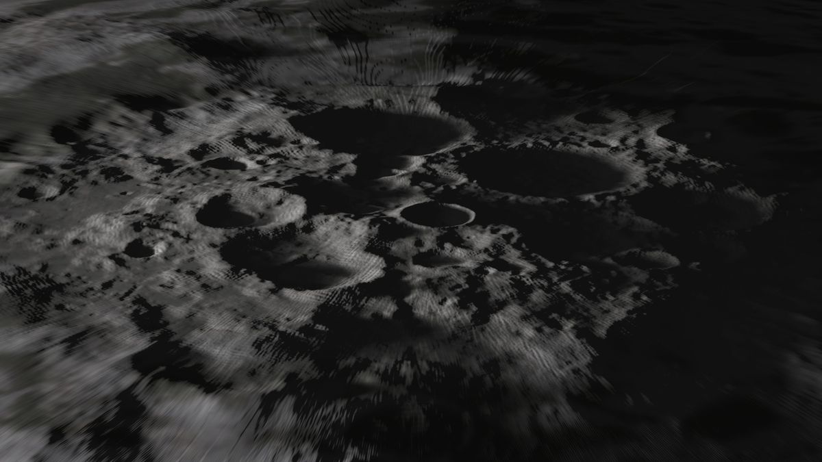
Researchers have discovered a method for making high-resolution maps of planetary surfaces like the moon’s by combining available imagery and topography data.
Mapping the complex and diverse surface of a world like the moon in detailed resolution is challenging because laser altimeters, which measure changes in altitudes, operate at much lower resolution than cameras. And although photographs offer a sense of surface features, it’s difficult to translate images into specific heights and depths.
However, a new method combines topographic data with degrees of shading of sunlight present in optical images to provide much more accurate assessments of landforms and structures. The development could help both astronauts and robotic explorers in the future.
Related: Rogue rocket’s moon crash site spotted by NASA probe (photos)
The new method was developed by Iris Fernandes, a now former Ph.D. student at the Niels Bohr Institute of the University of Copenhagen in Denmark.
Different missions deliver very different data resolutions, so combining different sources of data in different resolutions presents a huge mathematical problem. What Fernandes and her then-supervisor, geophysicist Klaus Mosegaard, did differently was to focus on the mathematics of the issue, narrowing down the challenge to determine whether an equation could solve the problem.
“And it did,” Fernandes said in a statement (opens in new tab), explaining that they had found a “mathematical key to a door that had remained closed for many years.”
The new approach also requires much less computational power and is much faster than previous methods, according to the researchers.
The researchers demonstrated the technique on the moon. By combining high-resolution images from NASA’s Lunar Reconnaissance Orbiter‘s LROC camera with lower-resolution data from the spacecraft’s Lunar Orbiter Laser Altimeter (LOLA), the authors of the paper state they increased the resolution of the topography from around 200 feet (60 meters) per pixel to 2.95 feet (0.9 m) per pixel.
Related stories:
Going forward, the authors argue, the method can be applied to extract precise topographic details on rock formations on planetary bodies such as the moon, Mars, asteroids and any other worlds for which topographic data is available.
The method can support a range of different purposes, including determining the safety of astronauts and rovers or finding geologically interesting sites, and it can be applied to images coming from satellites, rovers or other spacecraft.
The research is described in an article published June 8 in the journal Planetary and Space Science (opens in new tab).
Follow us on Twitter @Spacedotcom (opens in new tab) and on Facebook (opens in new tab).


