The United Nations has activated its emergency mapping satellite service following a devastating earthquake that struck Turkey and Syria on Monday (Feb. 6).
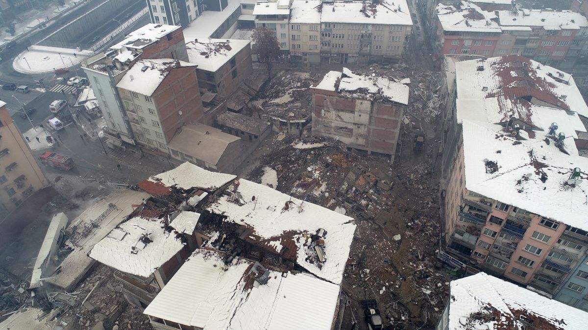
The magnitude 7.8 earthquake caused widespread destruction throughout Turkey and northwest Syria, claiming the lives of more than 2,000 people and injuring thousands more, Reuters reports (opens in new tab). The epicenter of the 11-mile-deep (18 kilometers) earthquake appears to have been along the southern border of Turkey just west of the city of Gaziantep, according to data (opens in new tab) collected by the United States Geological Survey.
In the wake of the damaging earthquake, the United Nations Satellite Centre (opens in new tab) (UNOSAT) announced via Twitter on Monday (opens in new tab)(Feb. 6) that it has activated its emergency mapping service, which “provides satellite image analysis during humanitarian emergencies related to disasters, complex emergencies and conflict situations.”
Related: Earthquakes: What are they and how do they occur?
A live map that contains geospatial data related to the Feb. 6 earthquake in Turkey and Syria can be found on UNOSAT’s website (opens in new tab). The map provides an overview of structures that were damaged or potentially damaged by the earthquake, which can then be used by humanitarian relief and disaster response groups in order to best respond to the still-unfolding crisis.
Groups such as United Nations offices and agencies, governmental agencies, relief organizations such as the Red Cross and Red Crescent and non-governmental humanitarian organizations can all request access to the imagery collected by UNOSAT.
RELATED STORIES:
UNOSAT began in 2001 and is hosted at the European Organization for Nuclear Research, or CERN. Its initial focus was to provide the United Nations with satellite analysis and training for U.N. member states, but by 2003 the center had expanded into offering rapid mapping services for humanitarian efforts such as what is currently unfolding in Turkey.
The center does not operate its own satellites (opens in new tab), but instead coordinates with U.N. member states to gather imagery from their governmental agencies and private satellite firms.
Follow Brett on Twitter at @bretttingley (opens in new tab). Follow us @Spacedotcom (opens in new tab), or on Facebook (opens in new tab) and Instagram (opens in new tab).