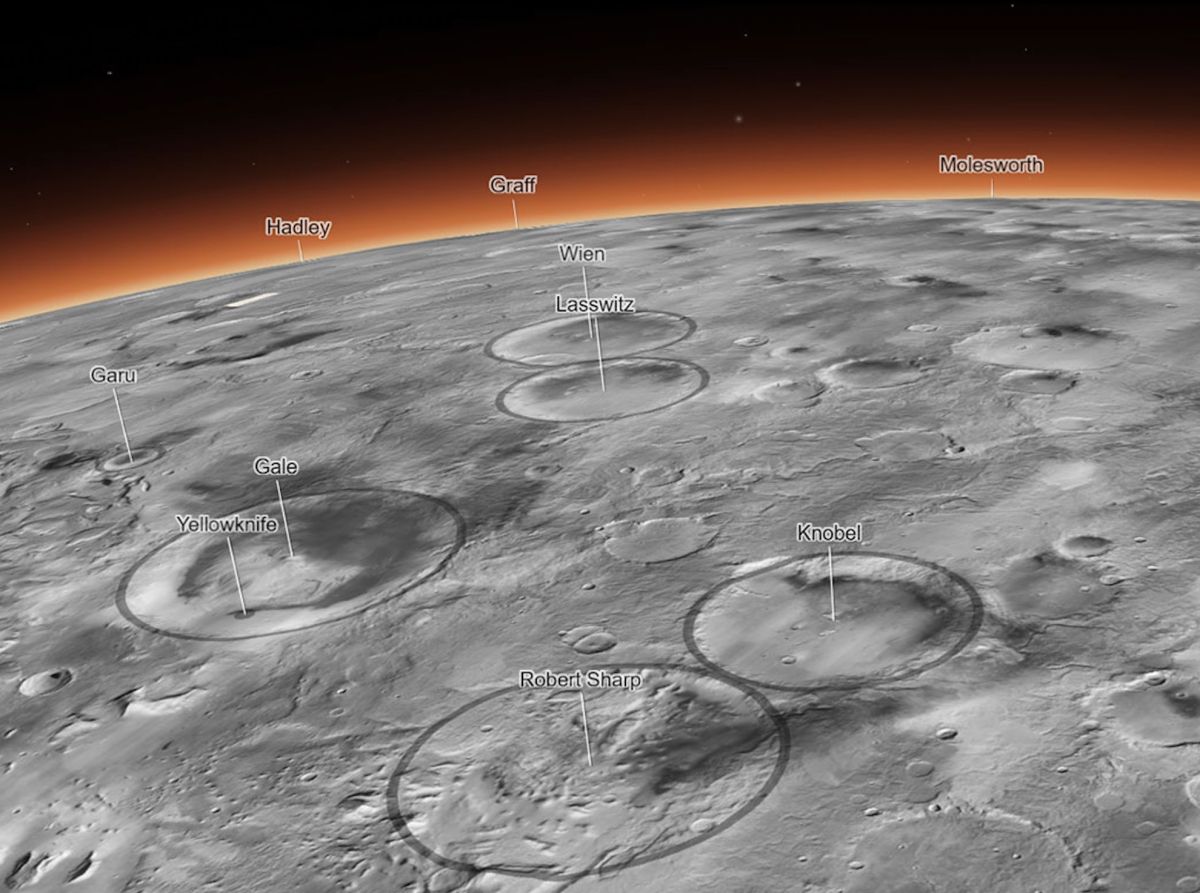

If you’re the kind of person who can spend hours upon hours clicking around Google Earth, there’s a new toy for you. NASA has just released the most detailed 3D map of Mars ever made.
Created by the Bruce Murray Laboratory for Planetary Visualization at the California Institute of Technology in Pasadena, the interactive Global CTX Mosaic of Mars map (opens in new tab) is a mosaic created from images taken by NASA’s Mars Reconnaissance Orbiter — more specifically, its black-and-white Context Camera.
The team developed the map over a period of six years, stitching together some 110,000 Mars images. Most of the images were organized using a computer algorithm, but 13,000 were added to the map manually by researchers.
Related: New Mars water map reveals history of Red Planet
The map is so detailed that it covers some 270 square feet (25 square meters) of the Martian surface in each pixel. Put another way: If the map were to be printed out, the 5.7 trillion–pixel (5.7-terapixel) image would be larger than a football field.
“I’ve wanted something like this for a long time. It’s both a beautiful product of art and also useful for science,” Laura Gerber, a Mars scientist at NASA’s Jet Propulsion Laboratory in California, said in a statement (opens in new tab).
In fact, 120 peer-reviewed papers have already cited the map’s beta version, demonstrating its benefit to scientists.
But the map is also available to the public — and it’s exceptionally easy to use. Simply open the map in a web browser, then click around to explore different regions of the planet, zooming in to see details like dust devil tracks crisscrossing the surface.
There are even tabs to click that will bring you to points of interest, like Jezero Crater, where NASA’s Perseverance rover is currently working, and Olympus Mons, the largest volcano in the solar system.
Related stories:
“I wanted something that would be accessible to everyone,” Murray Lab manager Jay Dickson, who led the project, said in the statement. “Schoolchildren can use this now. My mother, who just turned 78, can use this now. The goal is to lower the barriers for people who are interested in exploring Mars.”
To access the map, visit murray-lab.caltech.edu (opens in new tab).
Follow Stefanie Waldek on Twitter @StefanieWaldek (opens in new tab). Follow us on Twitter @Spacedotcom (opens in new tab) or on Facebook (opens in new tab).