4 min read
Sols 4343-4344: Late Slide, Late Changes
Earth planning date: Wednesday, Oct. 23, 2024
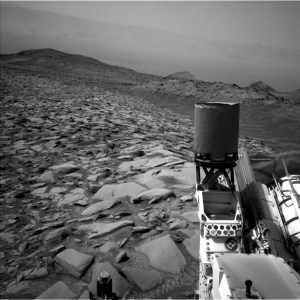
Curiosity is driving along the western edge of the Gediz Vallis channel, heading for a good vantage point before turning westward and leaving the channel behind to explore the canyons beyond. The contact science for “Chuck Pass” on sol 4341 and backwards 30-meter drive (about 98 feet) on sol 4342 completed successfully.
This morning, planning started two hours later than usual. At the end of each rover plan is a baton pass involving Curiosity finishing its activities from the previous plan, transmitting its acquired data to a Mars-orbiting relay satellite passing over Gale Crater, and having that satellite send this data to the Deep Space Network on Earth. This dataset is crucial to our team’s decisions on Curiosity’s next activities. It is not always feasible for us to get our critical data transmitted before the preferred planning shift start time of 8 a.m. This leads to what we call a “late slide,” when our planning days start and end later than usual.
Today’s shift began as the “decisional downlink” arrived just before 10 a.m. PDT. The science planning team jumped into action as the data rolled in, completed plans for two sols of science activities, then had to quickly change those plans completely as the Rover Planners perusing new images from the decisional downlink determined that the position of Curiosity’s wheels after the drive would not support deployment of its arm, eliminating the planned use of APXS, MAHLI, and the DRT on interesting rocks in the workspace. However, the science team was able to pivot quickly and create an ambitious two-sol science plan for Curiosity with the other science instruments.
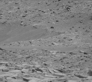
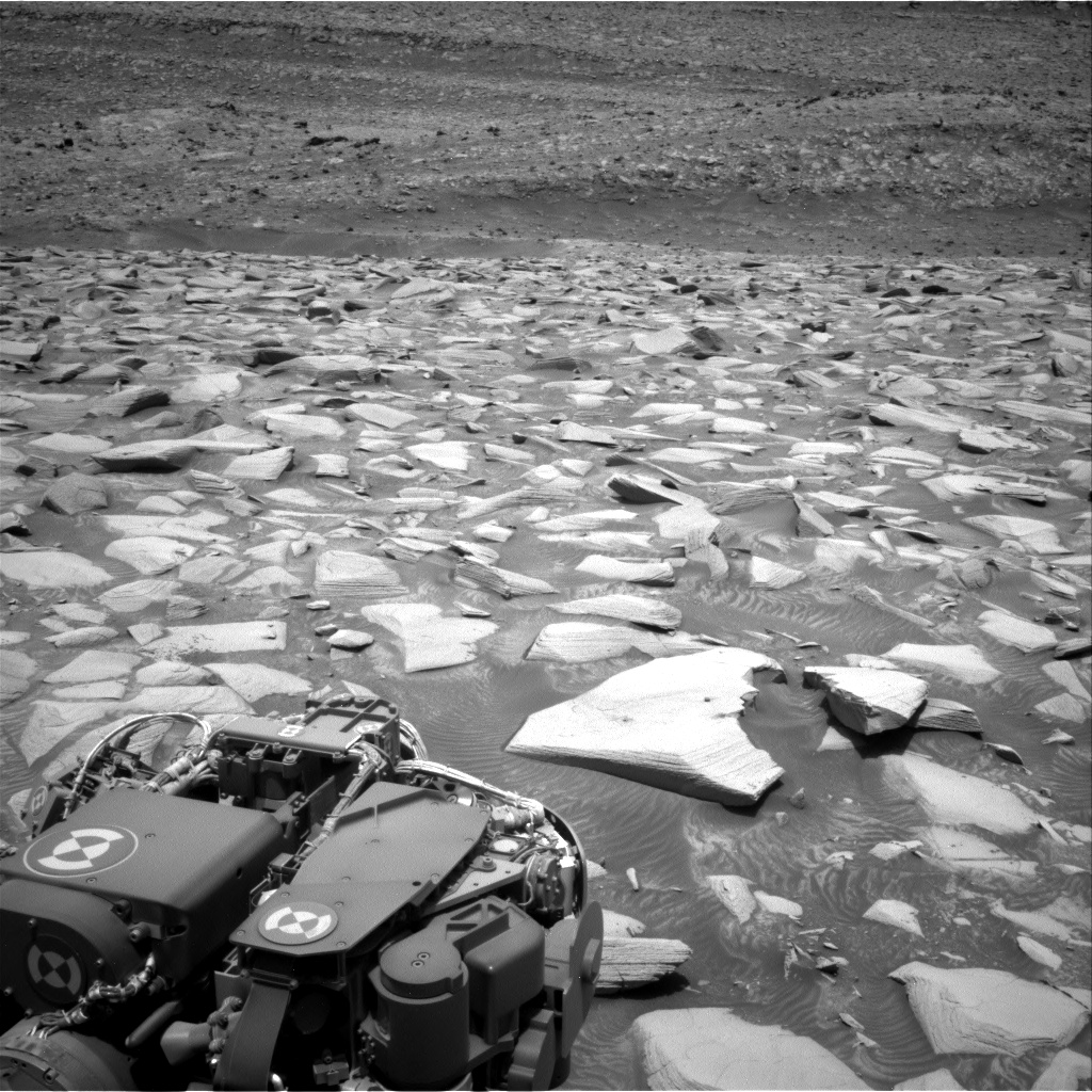
On sols 4343-4344, Curiosity will focus on examining blocks of finely layered or “laminated” bedrocks in its workspace. The “Backbone Creek” target, which has an erosion resistant vertical fin of dark material, will be zapped by the ChemCam laser to determine composition, and photographed by Mastcam. “Backbone Creek” is named for a stream in the western foothills of the Sierra Nevada of California flowing through a Natural Research Area established to protect the endangered Carpenteria californica woodland shrub. Curiosity is currently in the “Bishop” quadrangle on our map, so all targets in this area of Mount Sharp are named after places in the Sierra Nevada and Owens Valley of California. A neighboring target rock, “Fantail Lake,” which has horizontal fins among its layers, will also be imaged at high resolution by Mastcam. This target name honors a large alpine lake at nearly 10,000 feet just beyond the eastern boundary of Yosemite National Park. A fractured rock dubbed “Quarter Dome,” after a pair of Yosemite National Park’s spectacular granitic domes along the incomparable wall of Tenaya Canyon between Half Dome and Cloud’s Rest, will be the subject of mosaic images for both Mastcam and ChemCam RMI to obtain exquisite detail on delicate layers across its broken surface (see image). The ChemCam RMI telescopic camera will look at light toned rocks on the upper Gediz Vallis ridge. Curiosity will also do a Navcam dust devil movie and mosaic of dust on the rover deck, then determine dust opacity in the atmosphere using Mastcam.
Following this science block, Curiosity will drive about 18 meters (about 59 feet) and perform post-drive imaging, including a MARDI image of the ground under the rover. On sol 4344, the rover will do Navcam large dust devil and deck surveys. It will then use both Navcam and ChemCam for an AEGIS observation of the new location. Presuming that Curiosity ends the drive on more solid footing than today’s location, it will do contact science during the weekend plan, then drive on towards the next fascinating waypoint on our journey towards the western canyons of Mount Sharp.
Written by Deborah Padgett, OPGS Task Lead at NASA’s Jet Propulsion Laboratory