3 min read
Sols 4345-4347: Contact Science is Back on the Table
Earth planning date: Friday, Oct. 25, 2024
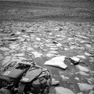
The changes to the plan Wednesday, moving the drive a sol earlier, meant that we started off planning this morning about 18 meters (about 59 feet) farther along the western edge of Gediz Vallis and with all the data we needed for planning. This included the knowledge that once again one of Curiosity’s wheels was perched on a rock. Luckily, unlike on Wednesday, it was determined that it was safe to still go ahead with full contact science for this weekend. This consisted of two targets “Mount Brewer” and “Reef Lake,” two targets on the top and side of the same block.
Aside from the contact science, Curiosity has three sols to fill with remote imaging. The first two sols include “targeted science,” which means all the imaging of specific targets in our current workspace. Then, after we drive away on the second sol, we fill the final sol of the plan with “untargeted science,” where we care less about knowing exactly where the rover is ahead of time. A lot of the environmental team’s (or ENV) activities fall under this umbrella, which is why our dedicated “ENV Science Block” (about 30 minutes of environmental activities one morning every weekend) tends to fall at the end of a weekend plan.
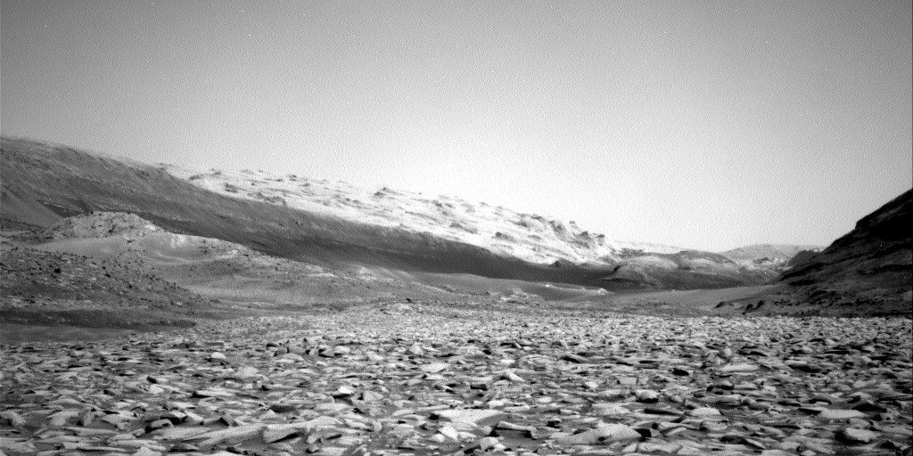
But that’s getting ahead of myself. The weekend plan starts off with two ENV activities — a dust devil movie and a suprahorizon cloud movie. While cloud movies are almost always pointed in the same direction, our dust devil movie has to be specifically targeted. Recently we’ve been looking southeast toward a more sandy area (which you can see above), to see if we can catch dust lifting there. After those movies we hand the reins back over to the geology team (or GEO) for ChemCam observations of Reef Lake and “Poison Meadow.” Mastcam will follow this up with its own observations of Reef Lake and the AEGIS target from Wednesday’s plan. The rover gets some well-deserved rest before waking up for the contact science I talked about above, followed by a late evening Mastcam mosaic of “Fascination Turret,” a part of Gediz Vallis ridge that we’ve seen before.
We’re driving away on the second sol, but before that we have about another hour of science. ChemCam and Mastcam both have observations of “Heaven Lake” and the upper Gediz Vallis ridge, and ENV has a line-of-sight observation, to see how much dust is in the crater, and a pre-drive deck monitoring image to see if any dust moves around on the rover deck due to either driving or wind. Curiosity gets a short nap before a further drive of about 25 meters (about 82 feet).
The last sol of the weekend is a ChemCam special. AEGIS will autonomously choose a target for imaging, and then ChemCam has a passive sky observation to examine changing amounts of atmospheric gases. The weekend doesn’t end at midnight, though — we wake up in the morning for the promised morning ENV block, which we’ve filled with two cloud movies, another line-of-sight, and a tau observation to see how dusty the atmosphere is.
Written by Alex Innanen, Atmospheric Scientist at York University
