NASA satellites looked down on huge cracks forming in sea ice in Canada’s far north.
What is it?
The Amundsen Gulf is named after Roald Amundsen, a Norwegian explorer who, in the early 1900s, embarked on a voyage into the Northwest Passage, a winding narrow passage through the Canadian Arctic Archipelago. Amundsen was hoping to use the Northern Passage as a shortcut, reducing travel time, according to NASA’s Earth Observatory.
After facing several hazards, his ship and crew successfully emerged from the passage, becoming the first people to successfully navigate the dangerous terrain. Amundsen’s ship, called the Gjøa, was only crewed by six men, all of whom helped conduct meteorological observations while sailing.
Where is it?
The Amundsen Gulf lies in the Northwest Territories of Canada.
Why is it amazing?
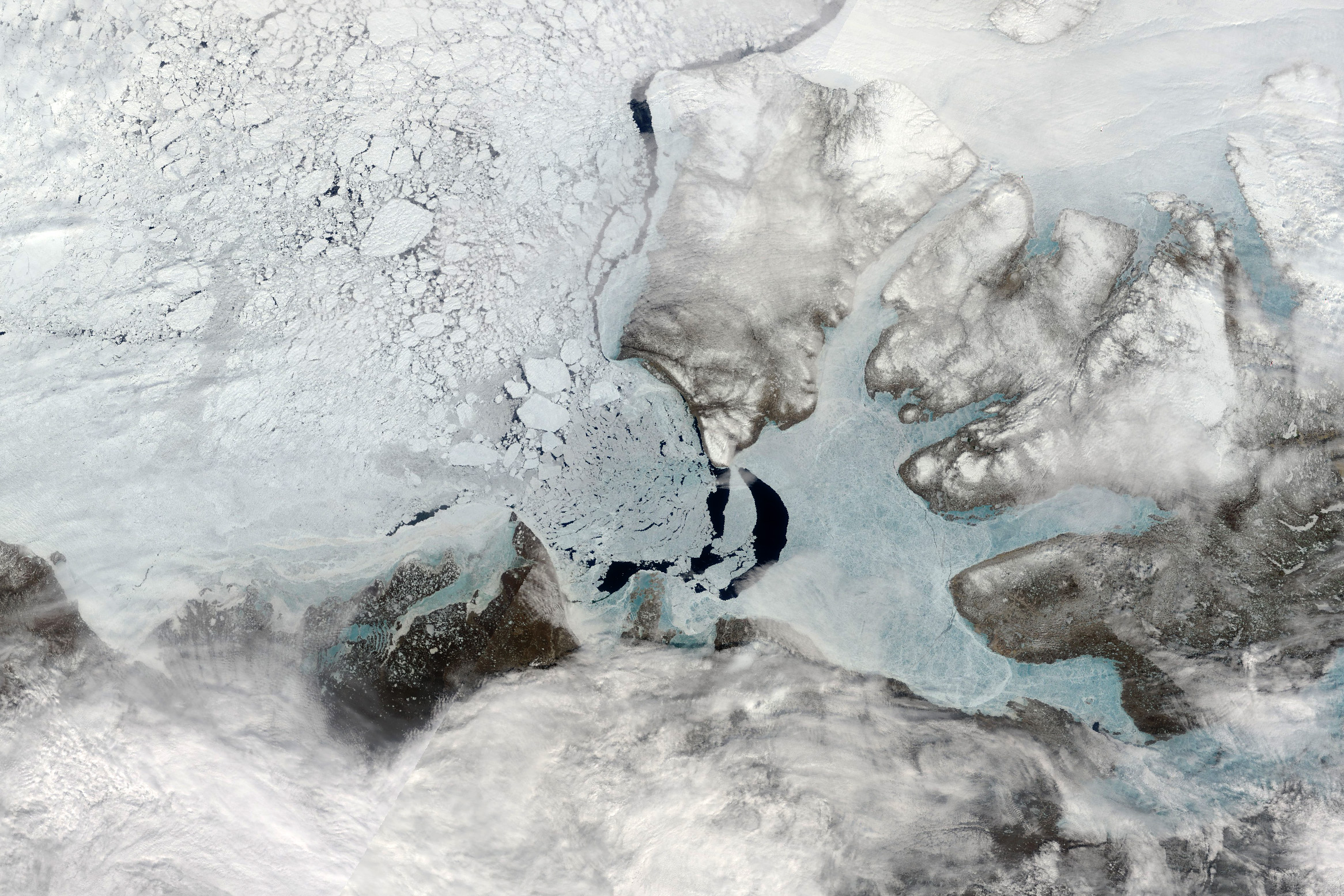
While Roald Amundsen and his crew paved the way for other ships to navigate the Northern Passage, the route still poses dangers for ships due to the shifting sea ice. Seasonal changes can cause sea ice to melt and break apart, drifting in the cold arctic waters. While this in itself may not be necessarily dangerous, if the sea ice accumulates enough, it can create “choke points” that block ships from sailing through.
In this image, taken by the MODIS (Moderate Resolution Imaging Spectroradiometer) on NASA’s Terra satellite, much of the sea ice is still “fastened” to the coastline, but other chunks have migrated into the Beaufort Sea. This ice break up will continue for several months as warmer temperatures and wind help to crack apart the thick arctic ice. The cycle usually begins in March 2025, according to NASA’s Earth Observatory
Want to learn more?
You can read more about sea ice levels in the arctic as satellites like Terra and other continue to observe Earth’s many beautiful structures.