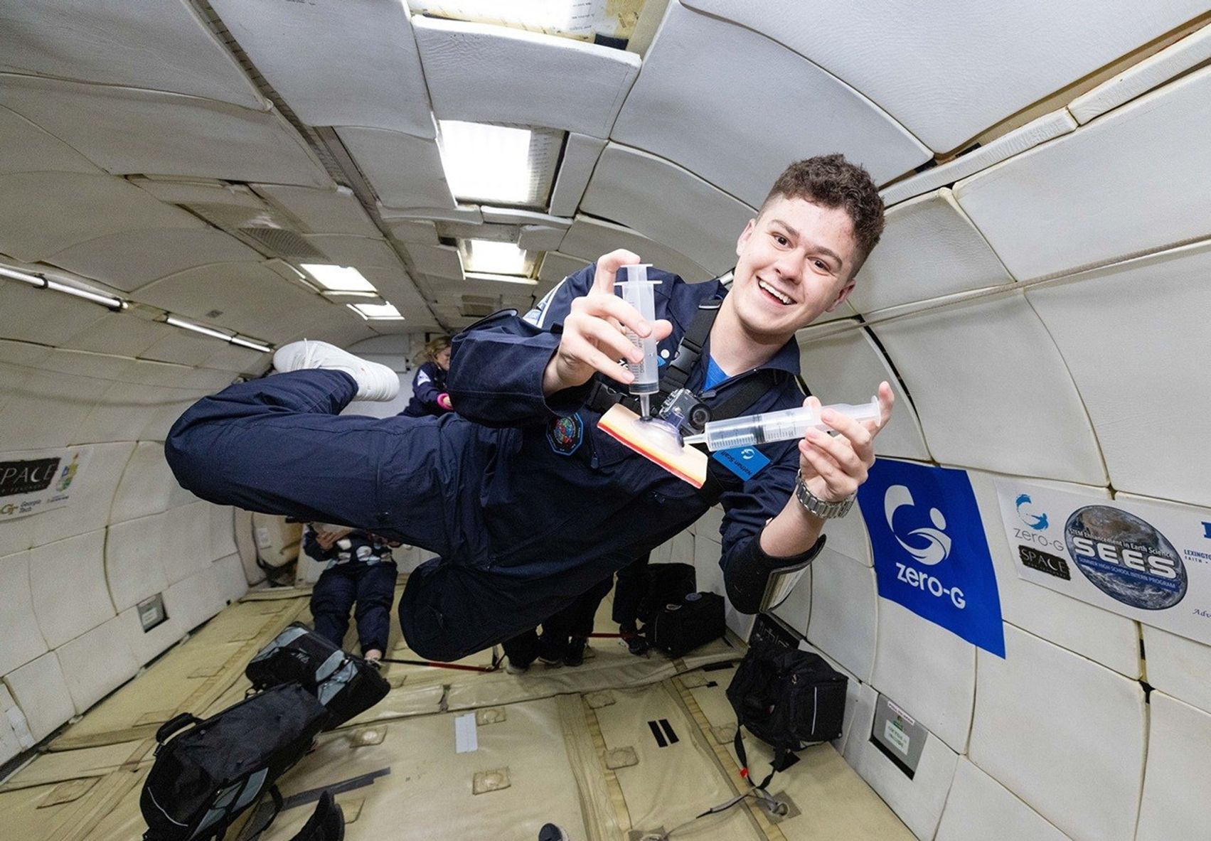
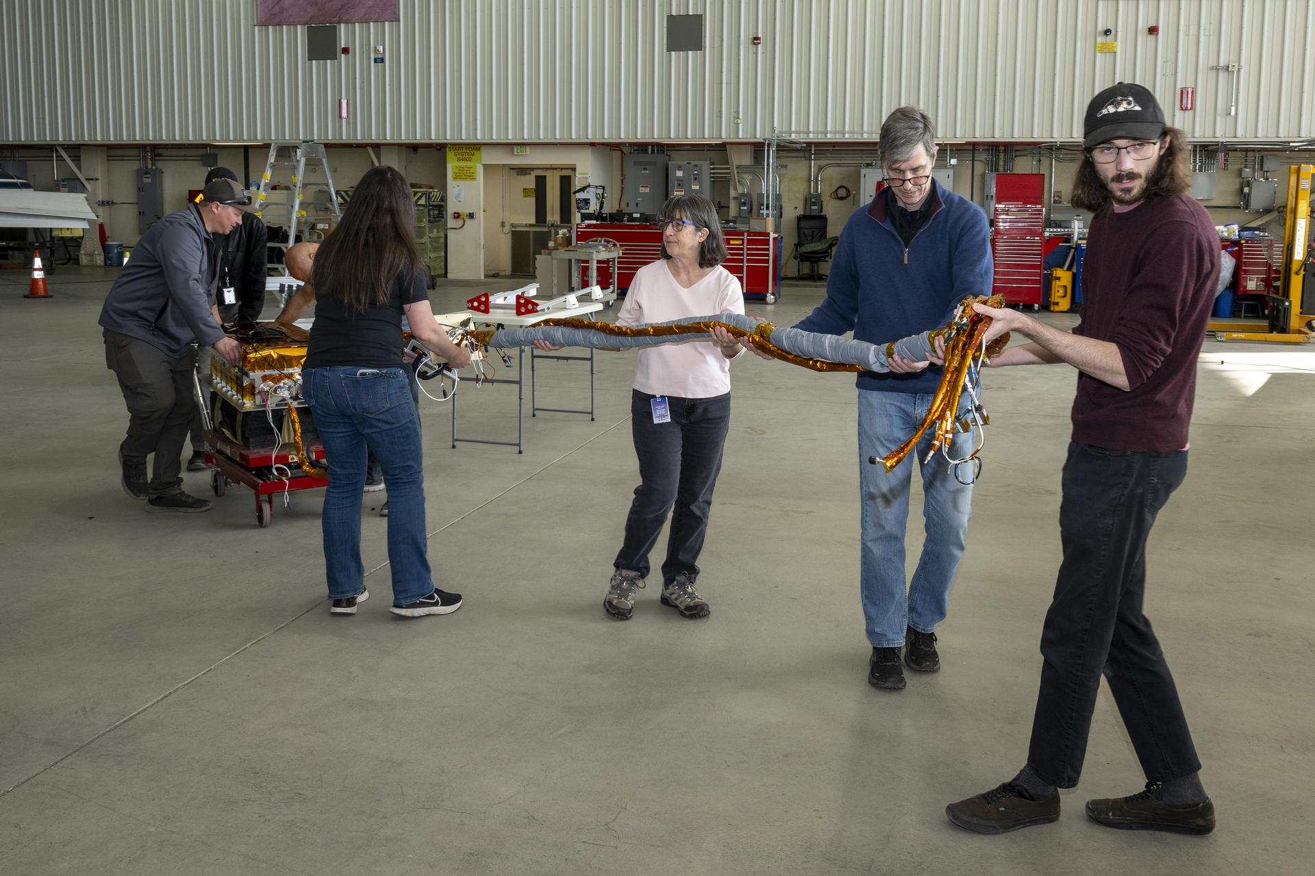
The Earth Observer Editor’s Corner: January–March 2025

Explore This Section Earth Home Earth Observer Home Editor’s Corner Feature Articles Meeting Summaries News Science in the News Calendars In Memoriam More Archives 11 min read The Earth Observer Editor’s Corner: January–March 2025 NASA’s Earth Observing fleet continues to age gracefully. While several new missions have joined the fleet in the past year, scientists and engineers work to extend the life of existing missions and maximize their science along the way. The crowning example is the first Earth Observing System (EOS) Flagship mission, Terra, which celebrated a quarter-century in…

Read More

NASA-ISRO Mission Will Map Farmland From Planting to Harvest

The NISAR mission will help map crops and track their development through the entire growing season. Using synthetic aperture radar, the satellite will be able to observe both small plots of farmland and monitor trends across broad regions, gathering data to in-form agricultural decision making. Adobe Stock/Greg Kelton Data from the NISAR satellite will be used to map crop growth, track plant health, and monitor soil moisture — offering detailed, timely information for decision making. When it launches this year, the NISAR (NASA-ISRO Synthetic Aperture Radar) satellite will provide a…

Read More

NASA Awards Launch Service for Mission to Study Storm Formation

Credit: NASA NASA has selected Firefly Aerospace Inc. of Cedar Park, Texas, to provide the launch service for the agency’s Investigation of Convective Updrafts (INCUS) mission, which aims to understand why, when, and where tropical convective storms form, and why some storms produce extreme weather. The mission will launch on the company’s Alpha rocket from NASA’s Wallops Flight Facility in Virginia. The selection is part of NASA’s Venture-Class Acquisition of Dedicated and Rideshare (VADR) launch services contract. This contract allows the agency to make fixed-price indefinite-delivery/indefinite-quantity awards during VADR’s five-year ordering period,…

Read More

NASA Uses New Technology to Understand California Wildfires

3 min read Preparations for Next Moonwalk Simulations Underway (and Underwater) The Compact Fire Infrared Radiance Spectral tracker, or C-FIRST, is managed an operated by NASA’s Jet Propulsion Laboratory, and supported by NASA’s Earth Science Technology Office. Combining state-of-the-art imaging technology with a compact design, C-FIRST enables scientists to gather data about fires and their impacts on ecosystems with greater accuracy and speed than other instruments. C-FIRST was developed as a spaceborne instrument, and flew onboard NASA’s B200 aircraft in January 2025 to conduct an airborne test. NASA/JPL-Caltech The January…

Read More

Commodity Classic Hyperwall Schedule

Explore This Section Earth Home Earth Observer Home Editor’s Corner Feature Articles Meeting Summaries News Science in the News Calendars In Memoriam More Archives 1 min read Commodity Classic Hyperwall Schedule NASA Science at Commodity Classic Hyperwall Schedule, March 2-4, 2025 Join NASA in the Exhibit Hall (Booth #839) for Hyperwall Storytelling by NASA experts. Full Hyperwall Agenda below. MONDAY, MARCH 3 11:30 – 12:00 PM NASA Earth Science at Work for American Agriculture Dr. Karen St. Germain 12:00 – 12:30 PM Connecting NASA Ag Resources in A Virtual Agricultural…

Read More

Summary of the 10th DSCOVR EPIC and NISTAR Science Team Meeting

Explore This Section Earth Home Earth Observer Home Editor’s Corner Feature Articles Meeting Summaries News Science in the News Calendars In Memoriam More Archives 21 min read Summary of the 10th DSCOVR EPIC and NISTAR Science Team Meeting Introduction The 10th Deep Space Climate Observatory (DSCOVR) Earth Polychromatic Camera (EPIC) and National Institute of Standards and Technology (NIST) Advanced Radiometer [NISTAR] Science Team Meeting (STM) was held October 16–18, 2024. Over 50 scientists attended, most of whom were from NASA’s Goddard Space Flight Center (GSFC), with several participating from other NASA centers, U.S. universities, and…

Read More

NASA Tests Drones to Provide Micrometeorology, Aid in Fire Response

5 Min Read NASA Tests Drones to Provide Micrometeorology, Aid in Fire Response Pilot in command Brayden Chamberlain performs pre-flight checks on the NASA Alta X quadcopter during the FireSense uncrewed aerial system (UAS) technology demonstration in Missoula. Credits: NASA ARC/Milan Loiacono In Aug. 2024, a team of NASA researchers and partners gathered in Missoula, to test new drone-based technology for localized forecasting, or micrometeorology. Researchers attached wind sensors to a drone, NASA’s Alta X quadcopter, aiming to provide precise and sustainable meteorological data to help predict fire behavior. Wildfires…

Read More

NASA Explores Earth Science with New Navigational System

3 min read Preparations for Next Moonwalk Simulations Underway (and Underwater) The G-IV aircraft flies overhead in the Mojave Desert near NASA’s Armstrong Flight Research Center in Edwards, California. Baseline flights like this one occurred in June 2024, and future flights in service of science research will benefit from the installment of the Soxnav navigational system, developed in collaboration with NASA’s Jet Propulsion Laboratory in Southern California and the Bay Area Environmental Research Institute in California’s Silicon Valley. This navigational system provides precise, economical aircraft guidance for a variety of…

Read More

NASA Radar Imagery Reveals Details About Los Angeles-Area Landslides

NASA’s UAVSAR airborne radar instrument captured data in fall 2024 showing the motion of landslides on the Palos Verdes Peninsula following record-breaking rainfall in Southern California in 2023 and another heavy-precipitation winter in 2024. Darker red indicates faster motion. NASA Earth Observatory Analysis of data from NASA radar aboard an airplane shows that the decades-old active landslide area on the Palos Verdes Peninsula has expanded. Researchers at NASA’s Jet Propulsion Laboratory in Southern California used data from an airborne radar to measure the movement of the slow-moving landslides on the…

Read More

Station Science Top News: Jan. 10, 2025

Measurements from space support wildfire risk predictions Researchers demonstrated that data from the International Space Station’s ECOsystem Spaceborne Thermal Radiometer Experiment on Space Station (ECOSTRESS) instrument played a significant role in the ability of machine learning algorithms to predict wildfire susceptibility. This result could help support development of effective strategies for predicting, preventing, monitoring, and managing wildfires. As the frequency and severity of wildfires increases worldwide, experts need reliable models of fire susceptibility to protect public safety and support natural resource planning and risk management. ECOSTRESS measures evapotranspiration, water use…

Read More