3 min read Preparations for Next Moonwalk Simulations Underway (and Underwater) Samuel Suleiman, an instructor for the OCEANOS internship, teaches students about sargassum and shore ecology on Culebra Island, Puerto Rico, during the fieldwork section of the project. Suleiman is also the Executive Director of Sociedad Ambiente Marino: a Puerto Rican NGO that works in conservation and coral reef restoration. NASA ARC/Milan Loiacono What is your name and your role with OCEANOS? My name is Samuel Suleiman and I am the Executive Director of Sociedad Ambiente Marino: an NGO in…
Read MoreTag: Earth Science Division
Interview with OCEANOS Instructor Roy Armstrong
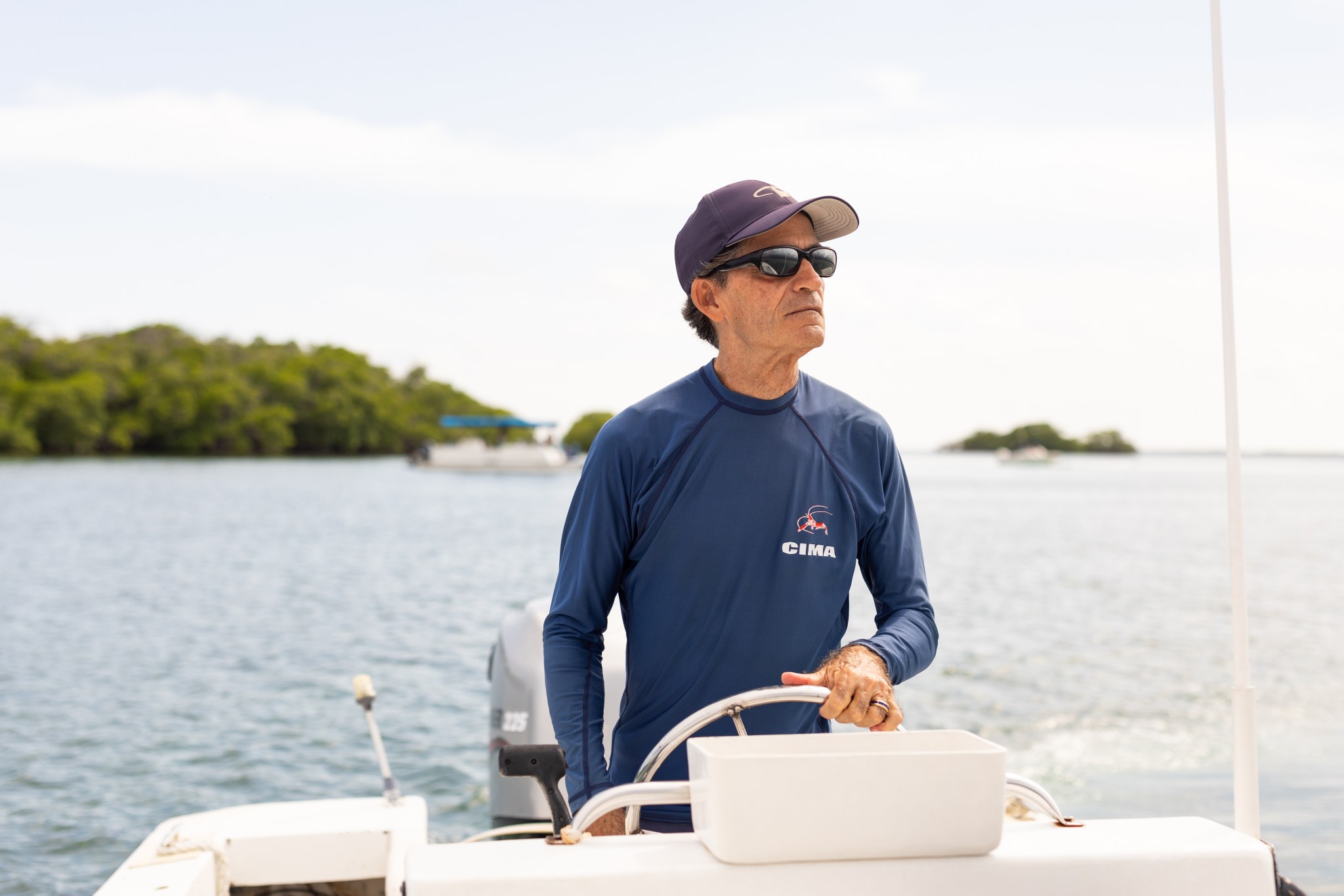
4 min read Preparations for Next Moonwalk Simulations Underway (and Underwater) Roy Armstrong, an instructor for the OCEANOS internship and marine sciences professor, pilots a small boat around the cays off the coast of La Parguera, Puerto Rico. NASA ARC/Milan Loiacono What is your name and your role with OCEANOS? My name is Ray Armstrong and I am a professor in the Department of Marine Sciences of the University of Puerto Rico. I came to be involved in OCEANOS because my ex-student and good friend Juan Torres-Perez, who works at…
Read MoreInternational SWOT Satellite Spots Planet-Rumbling Greenland Tsunami
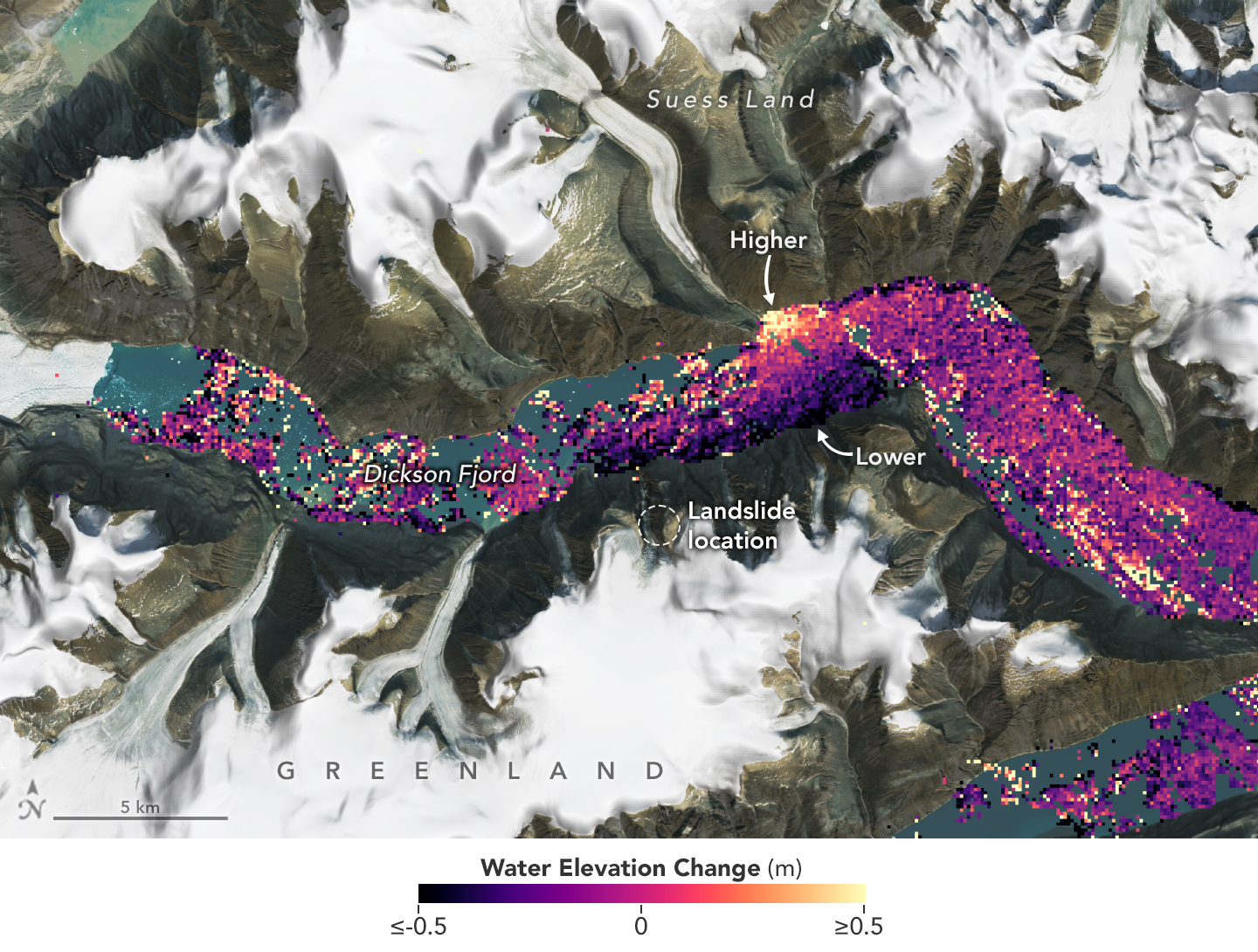
4 min read Preparations for Next Moonwalk Simulations Underway (and Underwater) A SWOT data visualization shows water on the northern side of Greenland’s Dickson Fjord at higher levels than on the southern side on Sept. 17, 2023. A huge rockslide into the fjord the previous day led to a tsunami lasting nine days that caused seismic rumbling around the world. NASA Earth Observatory Data from space shows water tilting up toward the north side of the Dickson Fjord as it sloshed from south to north and back every 90 seconds…
Read MoreS-MODE, ASIA-AQ, and the Role of ESPO in Complex Airborne Campaigns
7 min read Preparations for Next Moonwalk Simulations Underway (and Underwater) Jhony Zavaleta, ASIA-AQ Project Manager, welcomes DC-8 Navigator Walter Klein and the rest of the aircraft crew to U-Tapao, Thailand for its initial arrival to the country during the ASIA-AQ campaign. Erin Czech (back, blue shirt) and Jaden Ta (front, black pants) served as part of the Thailand ESPO site management team, while Zavaleta and Sam Kim (far right) worked as the ESPO advance team to prepare each new site for the mission’s arrival. NASA Ames/Rafael Luis Méndez Peña…
Read MoreWhat is Air Quality?
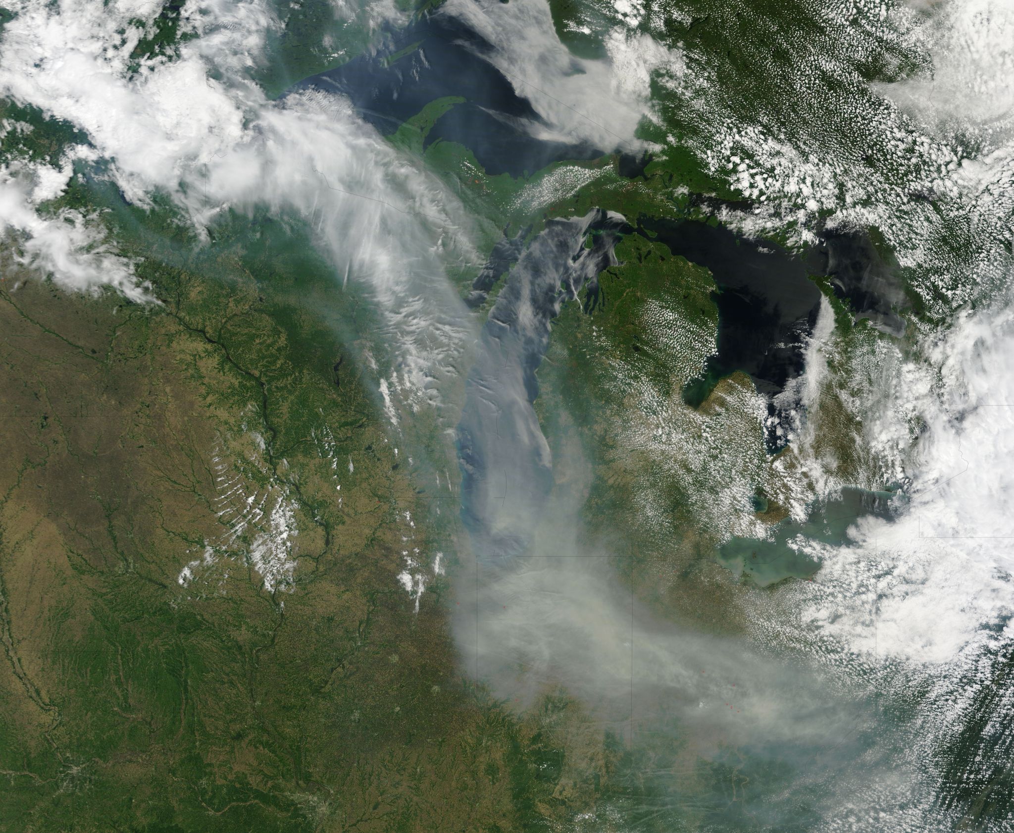
5 min read Preparations for Next Moonwalk Simulations Underway (and Underwater) Clean air is essential for healthy living, but according to the World Health Organization (WHO), almost 99% of the global population breathes air exceeding their guideline limits of air pollution. “Air quality is a measure of how much stuff is in the air, which includes particulates and gaseous pollutants,” said Kristina Pistone, a research scientist at NASA Ames Research Center. Pistone’s research covers both atmospheric and climate areas, with a focus on the effect of atmospheric particles on climate…
Read MoreWhat is a Coral Reef?
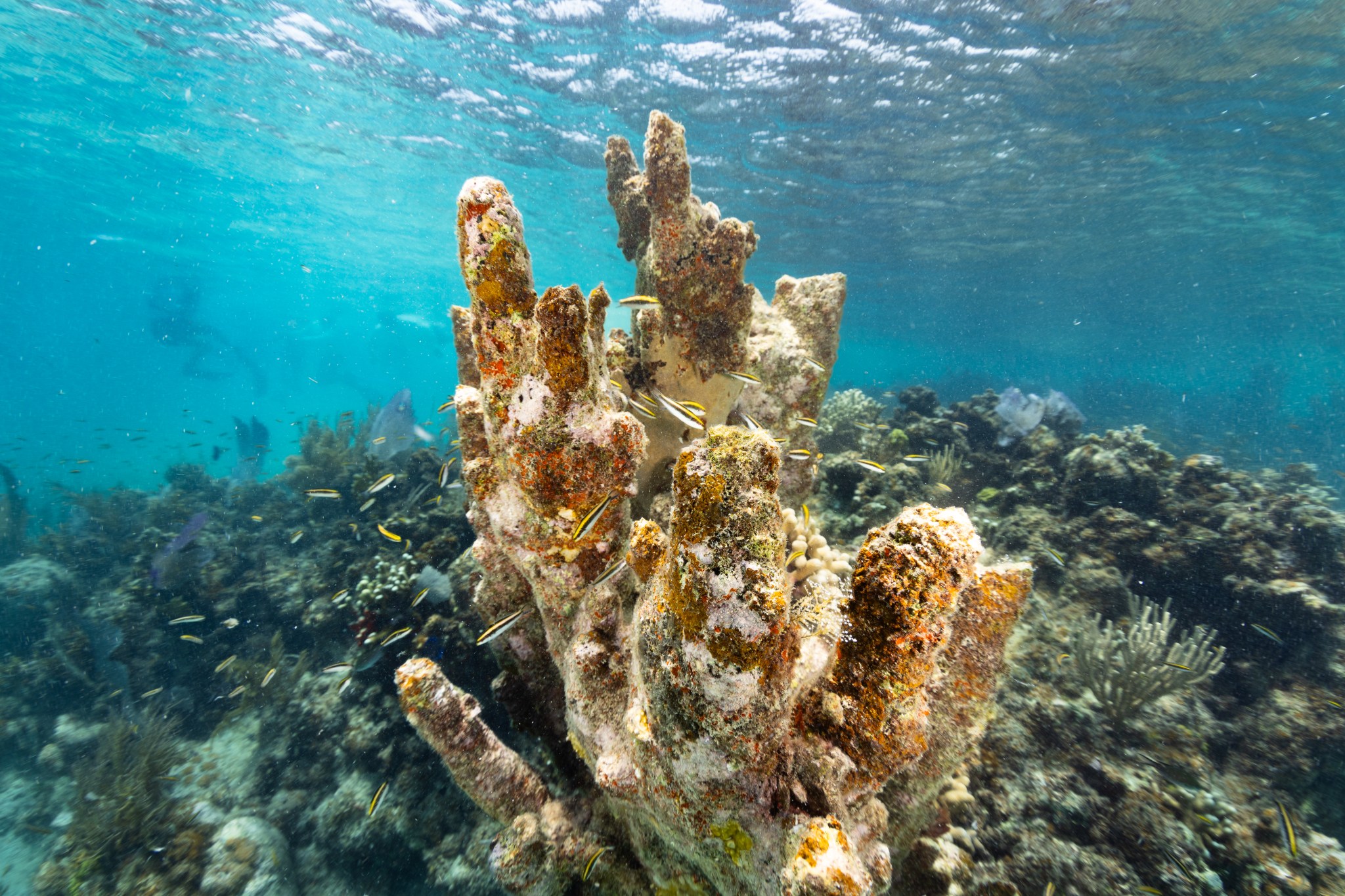
7 min read Preparations for Next Moonwalk Simulations Underway (and Underwater) Juvenile black, white, and yellow-striped Bluehead wrasse fish dart in and out of a dead colony of pillar coral (Dendrogyra cylindrus), now covered in various algae, in the waters of Playa Melones, Puerto Rico. NASA Ames/Milan Loiacono Coral reefs cover only 1% of the ocean floor, but support an estimated 25% of all marine life in the ocean, earning them the moniker ‘rainforest of the sea.’ They also play a critical role for coastal communities; preventing coastal erosion, protecting…
Read MoreOpenET: Balancing Water Supply and Demand in the West
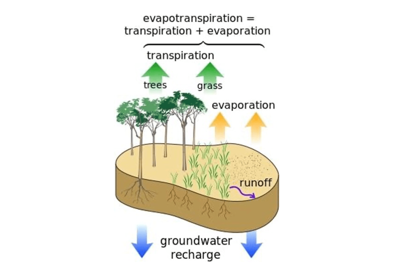
15 min read Preparations for Next Moonwalk Simulations Underway (and Underwater) At the end of 2022, 65 percent of the Western United States was in severe drought, the result of a two decades long mega drought in the Colorado River Basin that had captured headlines around the world. However, it was flooding, not drought, that was making headlines when we began our research for this story about OpenET, a revolutionary new online platform geared towards helping farmers and water managers monitor and reduce water use in watersheds where supplies were…
Read MoreNASA Invites Media to Preview its Museum Earth Information Center
Space for Earth is an immersive experience that is part of the Earth Information Center. Credit: NASA Media is invited to preview and interview NASA leadership ahead of the opening of the Earth Information Center at the Smithsonian National Museum of Natural History at 10 a.m. EDT, Monday, Oct. 7. The 2,000-square-foot exhibit includes a 32-foot-long, 12-foot-high video wall displaying Earth science data visualizations and videos, an interpretive panel showing Earth’s connected systems, information on our changing world, and an overview of how NASA and the Smithsonian study our home…
Read More2024 SARP West Closeout
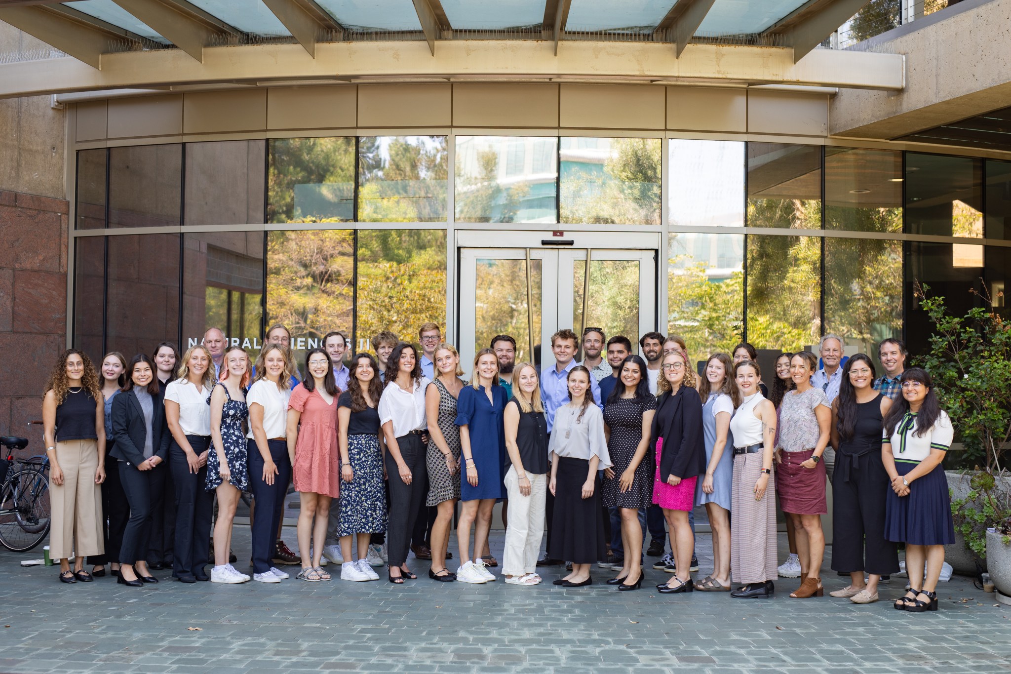
5 min read Preparations for Next Moonwalk Simulations Underway (and Underwater) The Student Airborne Research Program (SARP) 2024 West Coast cohort poses in front of the natural sciences building at UC Irvine, during their final presentations on August 12, 2024. NASA Ames/Milan Loiacono On August 12-13, 24 students from the West Coast cohort of NASA’s Student Airborne Research Program (SARP) gathered at University of California, Irvine (UCI) to present their final research to a room of mentors, professors, family, and NASA personnel. SARP is an eight-week summer internship for undergraduate…
Read MoreProyecto de la NASA en Puerto Rico capacita a estudiantes en biología marina
9 Min Read Proyecto de la NASA en Puerto Rico capacita a estudiantes en biología marina Una península cubierta por un bosque verde en la isla de Culebra se adentra en las aguas azules del Caribe mientras una tormenta cae a lo lejos. El azul turquesa que rodea la isla indica la presencia de aguas poco profundas, que son el hogar de los famosos arrecifes de coral de esta isla. Credits: Centro Ames de la NASA/Milan Loiacono Read this story in English here. Tainaliz Marie Rodríguez Lugo respiró hondo, se ajustó…
Read More
