Testing in the Clouds: NASA Flies to Improve Satellite Data

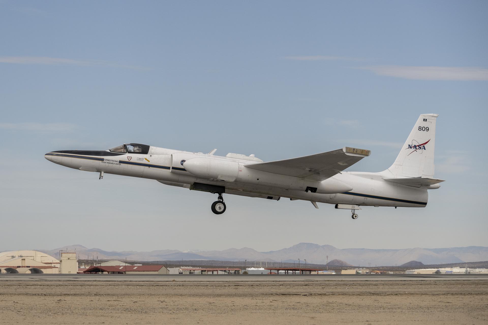
3 min read Preparations for Next Moonwalk Simulations Underway (and Underwater) Piloted by NASA’s Tim Williams, the ER-2 science aircraft ascends for one of the final science flights for the GSFC Lidar Observation and Validation Experiment (GLOVE) on Feb. 1, 2025. As a collaboration between engineers, scientists, and aircraft professionals, GLOVE aims to improve satellite data products for Earth Science applications. NASA/Steve Freeman In February, NASA’s ER-2 science aircraft flew instruments designed to improve satellite data products and Earth science observations. From data collection to processing, satellite systems continue to…

Read More

NASA Aims to Fly First Quantum Sensor for Gravity Measurements

Researchers from NASA’s Jet Propulsion Laboratory in Southern California, private companies, and academic institutions are developing the first space-based quantum sensor for measuring gravity. Supported by NASA’s Earth Science Technology Office (ESTO), this mission will mark a first for quantum sensing and will pave the way for groundbreaking observations of everything from petroleum reserves to global supplies of fresh water. A map of Earth’s gravity. Red indicates areas of the world that exert greater gravitational pull, while blue indicates areas that exert less. A science-grade quantum gravity gradiometer could one…

Read More

NASA Measures Moonlight to Improve Earth Observations

The airborne Lunar Spectral Irradiance (air-LUSI) instrument is moved across the hangar floor by robotic engineer Alexander McCafferty-Leroux ,from right to left, co-investigator Dr. John Woodward, NIST astronomer Dr. Susana Deustua, air-LUSI chief system engineer Dr. Kathleen “Kat” Scanlon, and members of the ER-2 ground crew at NASA’s Armstrong Flight Research Center in Edwards, California, in March 2025. NASA/Genaro Vavuris Flying high above the clouds and moon-gazing may sound like a scene from a timeless romance, but NASA did just that in the name of Earth science research. In March…

Read More

NASA Uses New Technology to Understand California Wildfires

3 min read Preparations for Next Moonwalk Simulations Underway (and Underwater) The Compact Fire Infrared Radiance Spectral tracker, or C-FIRST, is managed an operated by NASA’s Jet Propulsion Laboratory, and supported by NASA’s Earth Science Technology Office. Combining state-of-the-art imaging technology with a compact design, C-FIRST enables scientists to gather data about fires and their impacts on ecosystems with greater accuracy and speed than other instruments. C-FIRST was developed as a spaceborne instrument, and flew onboard NASA’s B200 aircraft in January 2025 to conduct an airborne test. NASA/JPL-Caltech The January…

Read More

NASA’s ORCA, AirHARP Projects Paved Way for PACE to Reach Space

It took the Plankton, Aerosol, Cloud, ocean Ecosystem (PACE) mission just 13 minutes to reach low-Earth orbit from Cape Canaveral Space Force Station in February 2024. It took a network of scientists at NASA and research institutions around the world more than 20 years to carefully craft and test the novel instruments that allow PACE to study the ocean and atmosphere with unprecedented clarity. In the early 2000s, a team of scientists at NASA’s Goddard Space Flight Center in Greenbelt, Maryland, prototyped the Ocean Radiometer for Carbon Assessment (ORCA) instrument,…

Read More