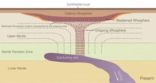
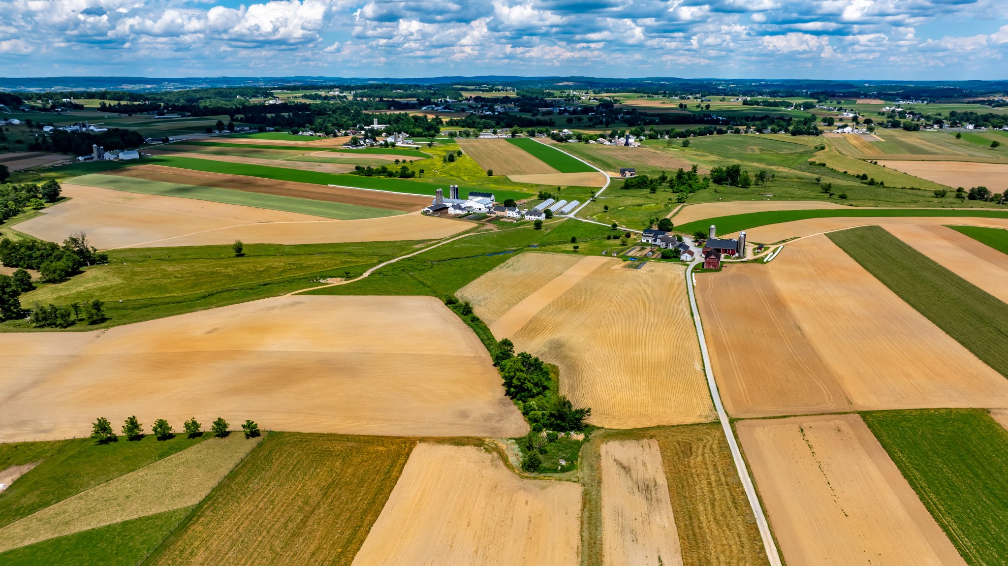
Scientists warn that the Trump administration’s abrupt firing of hundreds of weather forecasters and climate experts across NOAA will curtail important climate research and could result in preventable deaths during extreme weather events and related disasters. Over 800 employees across most divisions of the National Oceanic and Atmospheric Administration (NOAA) — a premier U.S. federal agency at the forefront of climate research that provides timely weather forecasts to the public for free — were dismissed in mass layoffs that began Thursday afternoon (Feb. 27). The cuts targeted probationary employees, a…
Read MoreTag: Earth
Our Pale Blue Dot
This updated version of “the Pale Blue Dot,” made for the photo’s 30th anniversary in 2020, uses modern image-processing software and techniques to revisit the well-known Voyager view while attempting to respect the original data and intent of those who planned the images. NASA/JPL-Caltech Earth is but a tiny light blue dot in this 30th anniversary version of the iconic “Pale Blue Dot” image. The original photo, taken by NASA’s Voyager 1 spacecraft on Feb. 14, 1990, is now 35 years old. Voyager 1 was 3.7 billion miles (6 billion…
Read MoreContinent-size blobs in Earth’s mantle are a billion years old, ancient crystals reveal
Continent-size islands deep inside Earth’s mantle could be more than a billion years old, a new study finds. Known as large low-seismic-velocity provinces (LLSVPs), these blobs are both hotter and older than nearby areas of the mantle. The findings, published Jan. 22 in the journal Nature, shed light on Earth’s deep interior and could help explain how the mantle moves over time. Scientists have known about these LLSVPs for a few decades. The two giant blobs — one beneath the Pacific Ocean and one beneath Africa — lie at the…
Read MoreNASA Radar Imagery Reveals Details About Los Angeles-Area Landslides
NASA’s UAVSAR airborne radar instrument captured data in fall 2024 showing the motion of landslides on the Palos Verdes Peninsula following record-breaking rainfall in Southern California in 2023 and another heavy-precipitation winter in 2024. Darker red indicates faster motion. NASA Earth Observatory Analysis of data from NASA radar aboard an airplane shows that the decades-old active landslide area on the Palos Verdes Peninsula has expanded. Researchers at NASA’s Jet Propulsion Laboratory in Southern California used data from an airborne radar to measure the movement of the slow-moving landslides on the…
Read MoreSatellites watch world’s largest iceberg on crash course with Antarctic penguin island (photo/video)
The world’s largest iceberg, A23a, is drifting toward South Georgia Island, a remote and ecologically vital wildlife haven. This massive block of ice, about the size of Rhode Island, poses a significant threat to the delicate ecosystem of the island, home to penguins and seals. Satellite images, including recent data captured by NOAA’s GOES East satellite on Jan. 22, 2025, are closely monitoring the iceberg’s slow journey through the Southern Ocean, where it could soon reach the shallow waters surrounding South Georgia. Breaking free Iceberg A23a has been a concern…
Read MoreEarth’s elusive ‘ignorosphere’ could shed new light on auroras
Japanese scientists have created the first-ever long-term dataset about Earth’s entire atmosphere, stretching all the way to space. They hope the project will help shed light on some little-explored processes taking place inside our planet’s gaseous shroud, including the magnificent northern lights. Some parts of Earth’s atmosphere are studied continuously in incredible detail. For example, millions of weather stations all around the world, hundreds of meteorological balloons and countless airplanes provide daily measurements of the entire troposphere, the atmosphere’s lowest region. The balloons also reach the lower part of the…
Read MoreScientists discover ‘sunken worlds’ hidden deep within Earth’s mantle that shouldn’t be there
Potential patches of Earth’s ancient crust, sometimes called “sunken worlds,” may have just been discovered deep within the mantle, thanks to a new way of mapping the inside of our planet. However, these mysterious blobs appear in places they should not, leaving researchers scratching their heads. For decades, scientists have been building up a better picture of Earth’s interior by using seismographs — 3D images created by measuring how seismic waves from earthquakes reverberate deep within our planet. This method has helped scientists identify ancient sections of the planet’s crust,…
Read MoreSatellites watch ‘ghost island’ solidify in the Caspian Sea before disappearing (photos)
We like to think of land as a fairly static thing, considering that’s where we spend the majority of our lives. And to think that the ground is ever-changing, well, that’s a bit unsettling. But the reality is land is always changing — perhaps nowhere more so than at the Kumani Bank mud volcano, also known as Chigil-Deniz, some 15 miles (25 km) off the coast of Azerbaijan in the Caspian Sea. The NASA Earth Observatory has released a series of images taken with the Operational Land Imager (OLI) and…
Read MoreNASA International Space Apps Challenge Announces 2024 Global Winners
6 Min Read NASA International Space Apps Challenge Announces 2024 Global Winners The 2024 NASA Space Apps Challenge was hosted at 485 events in 163 countries and territories. Credits: NASA NASA Space Apps has named 10 global winners, recognizing teams from around the world for their exceptional innovation and collaboration during the 2024 NASA Space Apps Challenge. As the largest annual global hackathon, this event invites participants to leverage open data from NASA and its space agency partners to tackle real-world challenges on Earth and in space. Last year’s hackathon…
Read MoreEarth in Far-Ultraviolet
NASA On April 21, 1972, NASA astronaut John W. Young, commander of the Apollo 16 mission, took a far-ultraviolet photo of Earth with an ultraviolet camera. Young’s original black-and-white picture was printed on Agfacontour professional film three times, with each exposure recording only one light level. The three light levels were then colored blue (dimmest), green (next brightest), and red (brightest), resulting in the enhanced-color image seen here. Dr. George Carruthers, a scientist at the Naval Research Laboratory, developed the ultraviolet camera – the first Moon-based observatory – for Apollo…
Read More