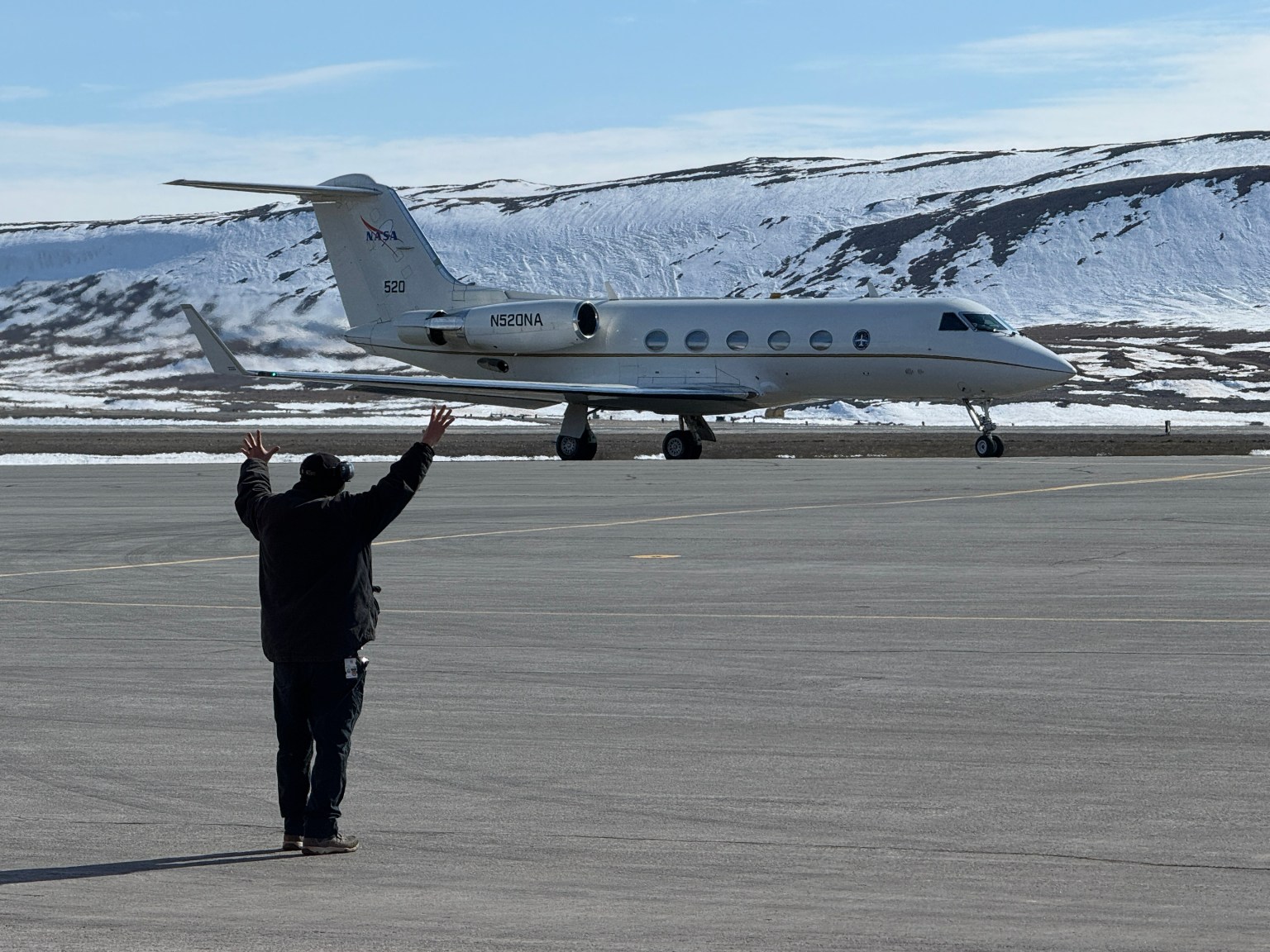
NASA-Led Mission to Map Air Pollution Over Both U.S. Coasts

2 min read Preparations for Next Moonwalk Simulations Underway (and Underwater) This summer between June 17 and July 2, NASA will fly aircraft over Baltimore, Philadelphia, parts of Virginia, and California to collect data on air pollutants and greenhouse gas emissions.   The campaign supports the NASA Student Airborne Research Program for undergraduate interns. Two NASA aircraft, including the P-3 shown here, will be flying over Baltimore, Philadelphia, Virginia and California between June 17 and July 2, to collect data on air pollutants and greenhouse gas emissions. Credit: (NASA/ Zavaleta)…

Read More

Alaska’s rivers are turning bright orange and as acidic as vinegar as toxic metal escapes from melting permafrost

Dozens of Alaskan rivers have turned bright orange in recent years because melting permafrost has released high levels of toxic metals into the waterways, a worrying new study reveals. The colorful contamination, which can be seen from space, is a potential ecological nightmare — and is likely to get even worse in the coming years, researchers say. In the new study, which was published May 20 in the journal Communications Earth & Environment, researchers identified at least 75 orange rivers and streams in a Texas-size area of Alaska’s Brooks mountain…

Read More

NASA Analysis Confirms a Year of Monthly Temperature Records

5 min read Preparations for Next Moonwalk Simulations Underway (and Underwater) This visualization shows monthly global surface temperatures from 1880 to May 2024. The last 12 months (June 2023 through May 2024) hit record highs for each respective month. Download this visualization from NASA Goddard’s Scientific Visualization Studio: https://svsdev.gsfc.nasa.gov/5311 NASA’s Scientific Visualization Studio May 2024 was the warmest May on the books, marking a full year of record-high monthly temperatures, NASA scientists found. Average global temperatures for the past 12 months hit record highs for each respective month – an…

Read More

Astronomy has a bullying and harassment issue: ‘Results presented in this report are bleak’

After surveying 661 employees affiliated with astronomy and geophysics professions, the Royal Astronomical Society (RAS) has stressed an “urgent” need to address bullying and harassment across the fields.  In short, 44% of respondents reported suffering in the workplace during the two years preceding the survey, and 65% of those respondents said reported concerns were either “ignored” or that their reports were unsatisfactorily handled. To be clear, the survey was conducted in 2020, and a soft-launch of the data was released in 2021. However, a full-fledged analysis of the results that…

Read More

2024 hurricane season should be busy, NOAA says

With La Nina conditions evolving in the Pacific and near-record warm waters in the Atlantic, scientists expect the 2024 Atlantic hurricane season to be a busy one. Forecasters at the Climate Prediction Center (CPC), part of the U.S. National Oceanic and Atmospheric Administration’s (NOAA) National Weather Service, release an outlook every year ahead of hurricane season that includes what kind of storm activity they predict between June 1 and Nov. 30.  CPC researchers say there’s an 85% chance that this year’s hurricane season will be more active than normal, with…

Read More

Modeling the Hawaiian Shoreline

NASA/Lisa Tanh, Matilda Anokye, Ian Lee, Connor Racette The island of Hawai’i and surrounding waters glow in unusual shades in this 2022 model made through NASA DEVELOP. The model was created to help the County of Hawai’i in their shoreline setback plan. The image shows areas of high flood risk (blue), as well as sea surface temperatures. Orange in the west indicates high temperatures, while red in the east represents low temperatures. NASA DEVELOP projects bridge the gap between NASA’s Earth science data and society, addressing environmental concerns and enhancing…

Read More

Satellite images of Rafah illustrate Palestinians fleeing the city

Satellite images taken earlier this month offer a spaceborne perspective of the ongoing Israel-Hamas war. They include scenes such as a before-and-after sequence that illustrates Palestinian civilians fleeing Rafah, a view of damaged buildings in the region and conglomerates of Israeli hardware.  For the past several months, Israeli Defense Forces (IDF) have destroyed major portions of areas in which Palestinian civilians live as a response to the Oct. 7 terrorist attack in Israel, an attack orchestrated by the radical militant group Hamas. As Reuters reported on May 14, Israel says…

Read More

Meet NASA Women Behind World’s Largest Flying Laboratory

5 min read Preparations for Next Moonwalk Simulations Underway (and Underwater) NASA’s DC-8 aircraft – the world’s largest flying science laboratory – began its science missions in 1987 and since then, has flown in service of the science community over places like Antarctica, Greenland, and Thailand. Aircraft like the DC-8 have enabled scientists to ask questions about life on Earth and explore them in a way that only NASA’s Airborne Science program can make happen. After 37 years, the DC-8 will retire to Idaho State University, where it will serve…

Read More

Next-gen satellites will paint a clearer picture of a changing Earth

Thanks to next-generation satellite systems scientists have in place, like the National Oceanic and Atmospheric Administration’s GOES-R series, scientists are able to get high-definition images of Earth faster than ever before. This is data that helps paint a full picture of our planet; the satellites can be thought of as in collaboration with one another, using special tools to make measurements and take observations that would otherwise be nearly impossible to perform from the ground directly. Yet, as our climate continues to change at a rapid rate due to human…

Read More

NASA-Led Study Provides New Global Accounting of Earth’s Rivers

5 min read Preparations for Next Moonwalk Simulations Underway (and Underwater) The Colorado River supplies water to more than 40 million people as it snakes through seven U.S. states, including the part of southeastern Utah seen in this photo snapped by an astronaut aboard the International Space Station. The Colorado basin was identified in a NASA-led study as a region experiencing intense human water use. NASA The novel approach to estimating river water storage and discharge also identifies regions marked by ‘fingerprints’ of intense water use. A study led by…

Read More