Linette Boisvert turned a childhood love of snow into a career as a sea ice scientist studying climate change. Name: Linette BoisvertTitle: Assistant Lab Chief, Cryospheric Sciences Branch, and Deputy Project Scientist for the Aqua SatelliteFormal Job Classification: Sea Ice ScientistOrganization: Cryospheric Science Branch, Science Directorate (Code 615) “When it snowed, school was cancelled so I loved winter weather, and I was fascinated how weather could impact our daily lives,” said Linette. “One of my undergraduate classes had a guest lecturer talk about the Arctic and that is when decided that I…
Read MoreTag: Ice & Glaciers
NASA Returns to Arctic Studying Summer Sea Ice Melt
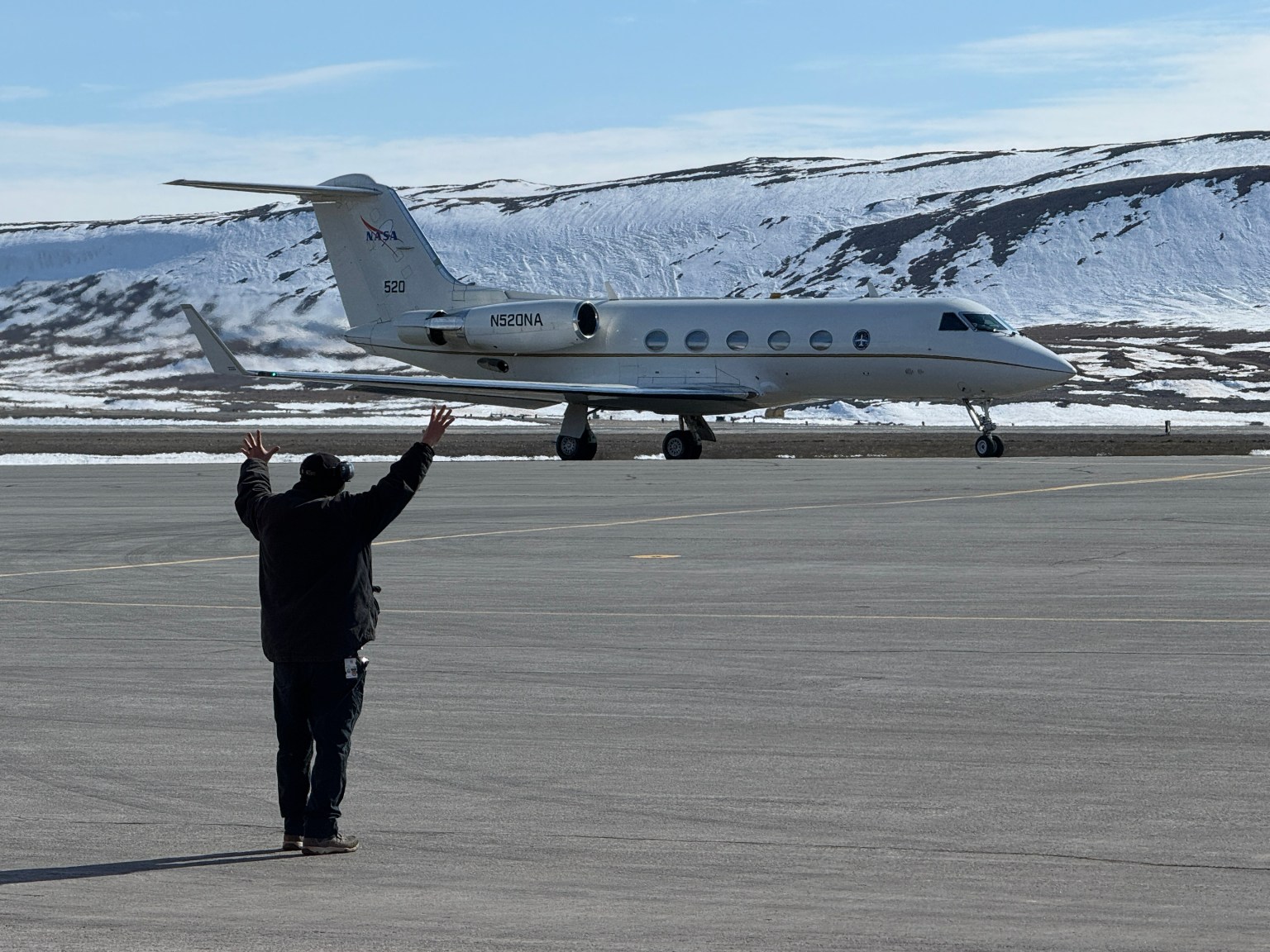
5 Min Read NASA Returns to Arctic Studying Summer Sea Ice Melt NASA's Gulfstream III aircraft taxis on the runway at Pituffik Space Base as it begins one of its daily science flights for the ARCSIX mission. Credits: NASA/Gary Banziger What happens in the Arctic doesn’t stay in the Arctic, and a new NASA mission is helping improve data modeling and increasing our understanding of Earth’s rapidly changing climate. Changing ice, ocean, and atmospheric conditions in the northernmost part of Earth have a large impact on the entire planet. That’s…
Read MoreStudying Arctic Ice
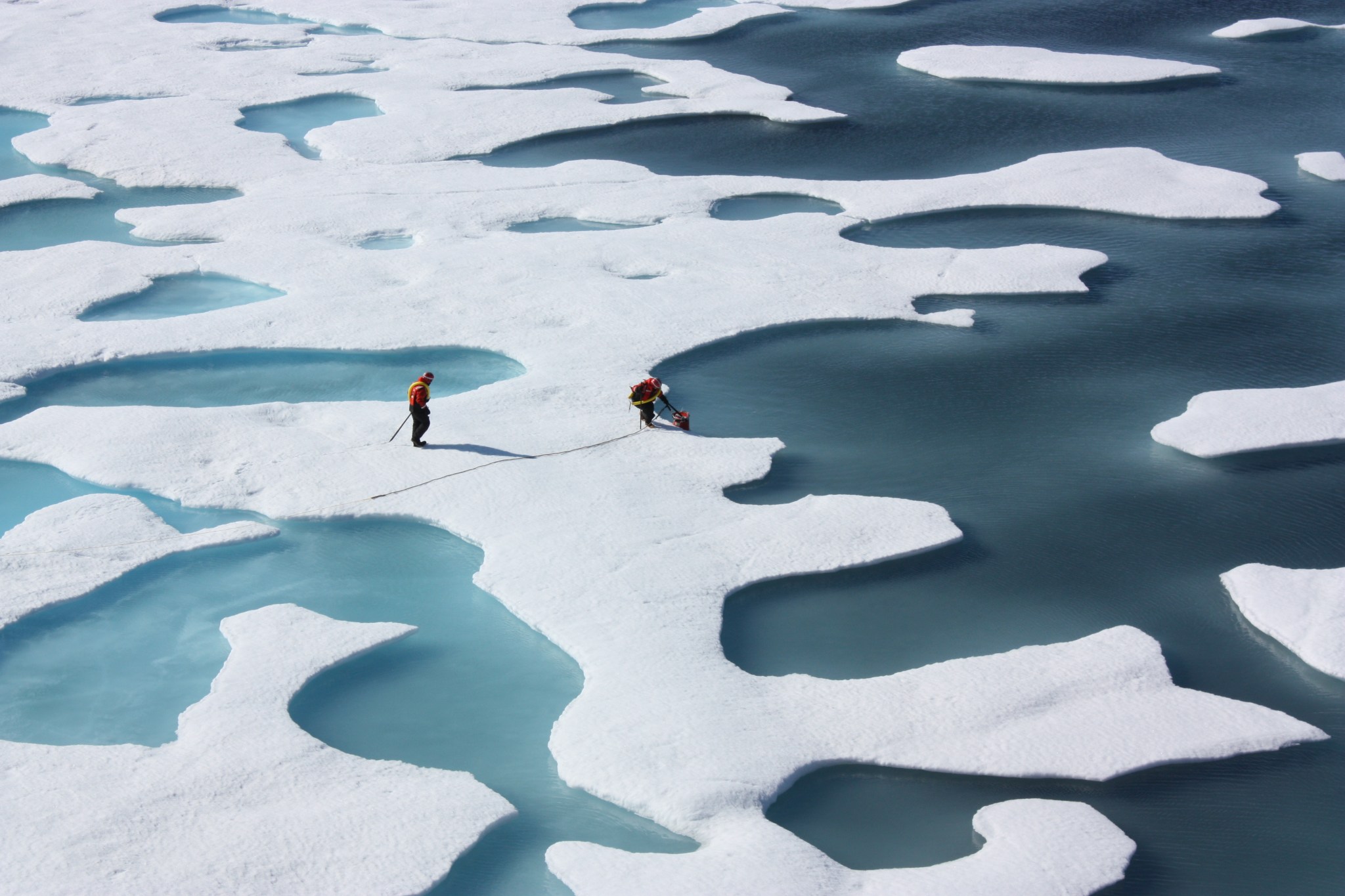
NASA/Kathryn Hansen In this image from July 12, 2011, crew from the U.S. Coast Guard Cutter Healy retrieve a supply canister dropped by parachute during the Impacts of Climate on Ecosystems and Chemistry of the Arctic Pacific Environment, or ICESCAPE, mission. ICESCAPE was a multi-year project sponsored by NASA to determine the impact of climate change upon the health of the Arctic Ocean. The bulk of the research took place in the Beaufort and Chukchi seas in summer 2010 and 2011. See more photos from this mission. Image Credit: NASA/Kathryn…
Read MoreThis US-Indian Satellite Will Monitor Earth’s Changing Frozen Regions
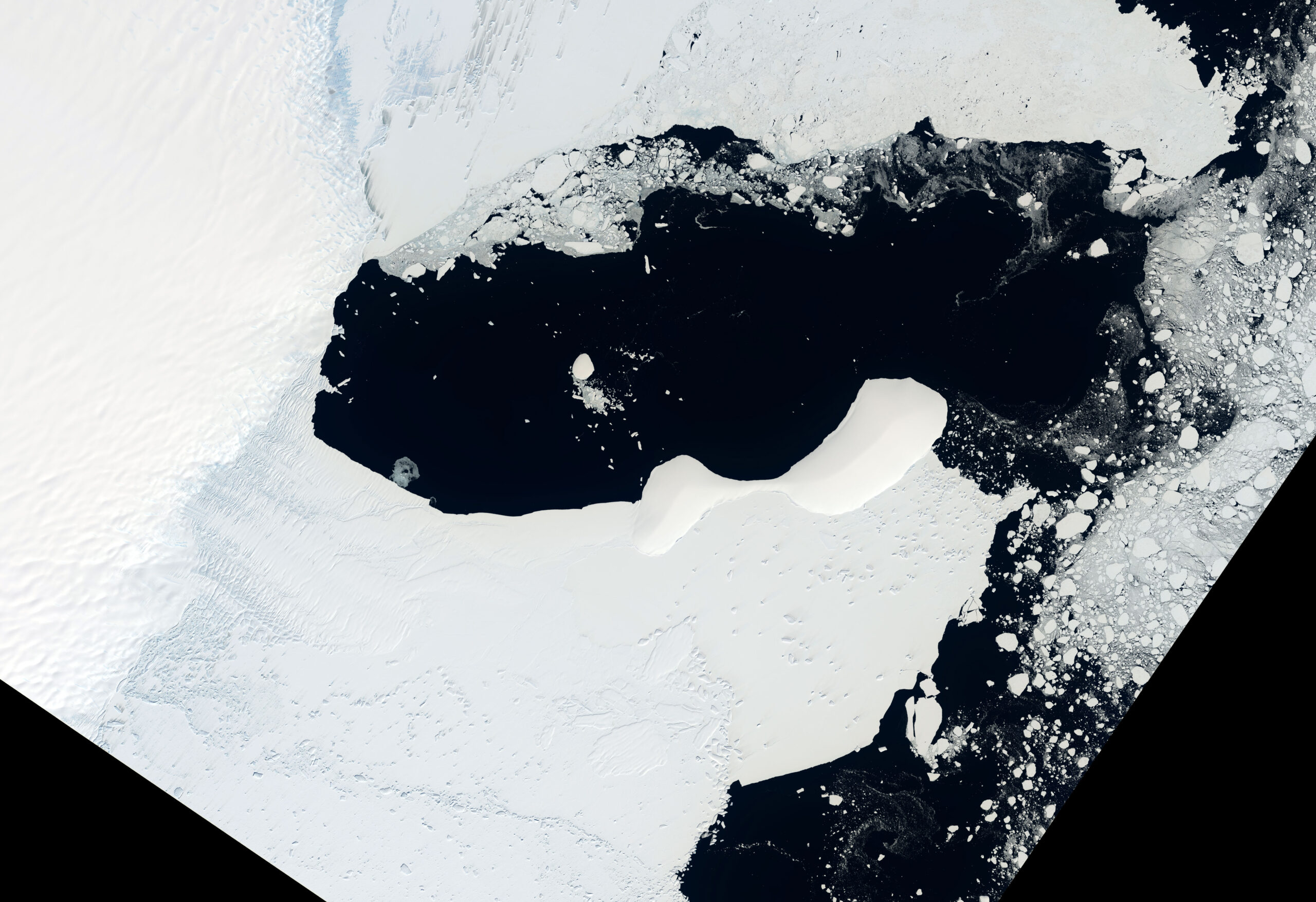
Satellite imagery shows a portion of East Antarctica on Jan. 9, 2022, before icebergs calved off the Glenzer and Conger glaciers. NISAR will observe nearly all of the planet’s land and ice surfaces twice every 12 days, monitoring Earth’s frozen regions, known as the cryosphere. USGS Much of the Glenzer and Conger glaciers had collapsed by March 23, 2022, spawning numerous icebergs, as shown in this satellite image. NISAR will document such changes around the globe, and its geographic coverage of Antarctica will be the most extensive for a radar…
Read More