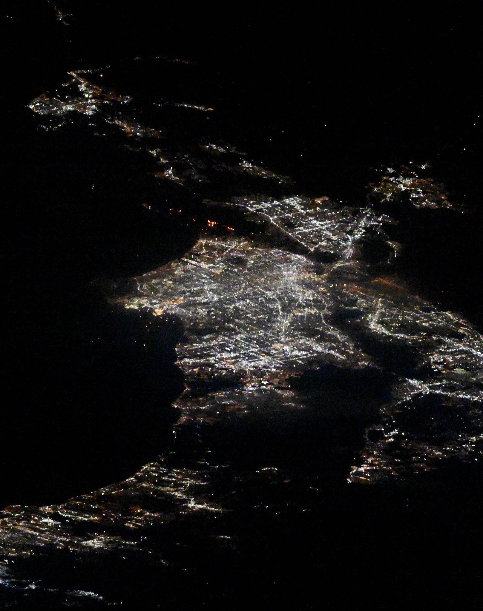
International SWOT Mission Can Improve Flood Prediction 

6 Min Read International SWOT Mission Can Improve Flood Prediction  Flooding on the Souris River inundated this community in North Dakota in 2011. The U.S.-French SWOT satellite is giving scientists and water managers a new tool to look at floods in 3D, information that can improve predictions of where and how often flooding will occur. A partnership between NASA and the French space agency, the satellite is poised to help improve forecasts of where and when flooding will occur in Earth’s rivers, lakes, and reservoirs. Rivers, lakes, and reservoirs are…

Read More

NASA Selects New Aircraft-Driven Studies of Earth and Climate Change

Earth (ESD) Earth and Climate Explore Climate Change Science in Action Multimedia Data More For Researchers 5 min read NASA Selects New Aircraft-Driven Studies of Earth and Climate Change NASA has selected six new airborne missions that include domestic and international studies of fire-induced clouds, Arctic coastal change, air quality, landslide hazards, shrinking glaciers, and emissions from agricultural lands. NASA’s suite of airborne missions complement what scientists can see from orbit, measure from the ground, and simulate in computer models.   Funded through the agency’s Earth Venture program, the missions…

Read More

NASA, Pacific Disaster Center Increase Landslide Hazard Awareness

5 min read NASA, Pacific Disaster Center Increase Landslide Hazard Awareness Communities worldwide now have access to a powerful tool to increase their awareness of landslide hazards, thanks to NASA and the Pacific Disaster Center. A humanitarian worker from USAID observes the impacts of a landslide. USAID deployed an elite Disaster Assistance Response Team on Nov. 17, 2020, to lead the U.S. response to Hurricanes Eta and Iota. USAID’s Bureau for Humanitarian Assistance After years of development and testing, NASA’s Landslide Hazard Assessment for Situational Awareness model (LHASA) has been…

Read More