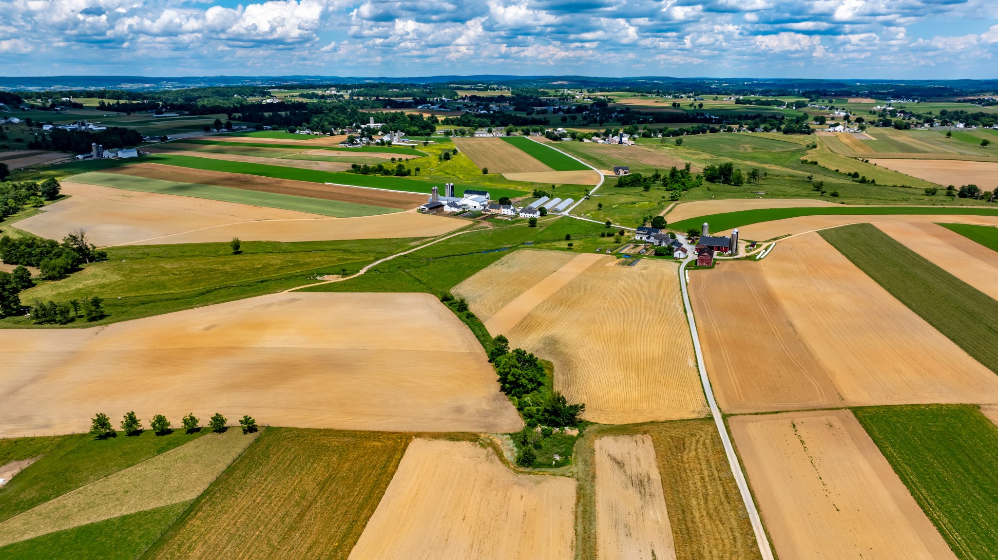
This US-Indian Satellite Will Monitor Earth’s Changing Frozen Regions

Satellite imagery shows a portion of East Antarctica on Jan. 9, 2022, before icebergs calved off the Glenzer and Conger glaciers. NISAR will observe nearly all of the planet’s land and ice surfaces twice every 12 days, monitoring Earth’s frozen regions, known as the cryosphere. USGS Much of the Glenzer and Conger glaciers had collapsed by March 23, 2022, spawning numerous icebergs, as shown in this satellite image. NISAR will document such changes around the globe, and its geographic coverage of Antarctica will be the most extensive for a radar…

Read More

NASA Administrator to Travel to India, UAE; Discuss Space Cooperation

NASA Administrator Bill Nelson gives remarks after Indian Ambassador to the United States Taranjit Sandhu signed the Artemis Accords, Wednesday, June 21, 2023, at the Willard InterContinental Hotel in Washington. NASA/Bill Ingalls NASA Administrator Bill Nelson will travel to India and the United Arab Emirates (UAE) for a series of meetings beginning Monday, Nov. 27, with key government officials. Nelson also will meet with space officials in both countries to deepen bilateral cooperation across a broad range of innovation and research-related areas, especially in human exploration and Earth science. The…

Read More

Trailblazing New Earth Satellite Put to Test in Preparation for Launch

The NISAR satellite enters the thermal vacuum chamber at an ISRO facility in Bengaluru on Oct. 19. It emerged three weeks later having met all requirements of its performance under extreme temperatures and space-like vacuum. ISRO During three weeks in a thermal vacuum chamber in Bengaluru, India, the joint NASA-ISRO satellite demonstrated its hardiness in a harsh, space-like environment. NISAR, the trailblazing Earth-observing radar satellite being developed by the United States and Indian space agencies, passed a major milestone on Nov. 13, emerging from a 21-day test aimed at evaluating…

Read More

NASA-ISRO Radar Mission to Provide Dynamic View of Forests, Wetlands

6 min read NASA-ISRO Radar Mission to Provide Dynamic View of Forests, Wetlands NISAR will use radar to study changes in ecosystems around the world, such as this forest in Tikal National Park in northern Guatemala, to understand how these areas are affected by climate change and human activity, and the role they play in the global carbon cycle. Credit: USAID NISAR will help researchers explore how changes in Earth’s forest and wetland ecosystems are affecting the global carbon cycle and influencing climate change. Once it launches in early 2024,…

Read More