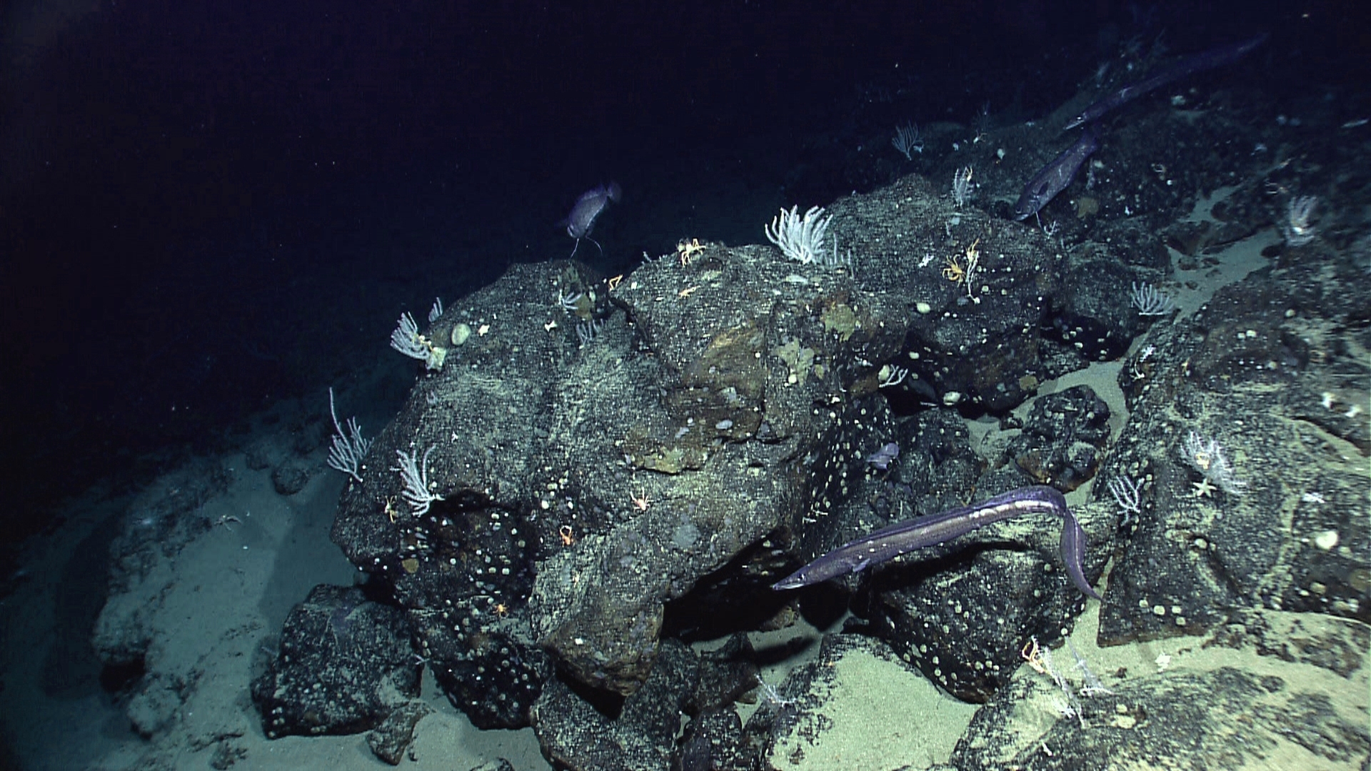
6 min read Preparations for Next Moonwalk Simulations Underway (and Underwater) Located off the coast of Ecuador, Paramount seamount is among the kinds of ocean floor features that certain ocean-observing satellites like SWOT can detect by how their gravitational pull affects the sea surface. NOAA Okeanos Explorer Program More accurate maps based on data from the SWOT mission can improve underwater navigation and result in greater knowledge of how heat and life move around the world’s ocean. There are better maps of the Moon’s surface than of the bottom of…
Read MoreTag: Oceans
NASA Analysis Shows Unexpected Amount of Sea Level Rise in 2024
3 min read Preparations for Next Moonwalk Simulations Underway (and Underwater) Communities in coastal areas such as Florida, shown in this 1992 NASA image, are vulnerable to the effects of sea level rise, including high-tide flooding. A new agency-led analysis found a higher-than-expected rate of sea level rise in 2024, which was also the hottest year on record. NASA Last year’s increase was due to an unusual amount of ocean warming, combined with meltwater from land-based ice such as glaciers. Global sea level rose faster than expected in 2024, mostly…
Read MoreNASA’s PACE Data on Ocean, Atmosphere, Climate Now Available
4 min read Preparations for Next Moonwalk Simulations Underway (and Underwater) NASA’s PACE satellite’s Ocean Color Instrument (OCI) detects light across a hyperspectral range, which gives scientists new information to differentiate communities of phytoplankton – a unique ability of NASA’s newest Earth-observing satellite. This first image released from OCI identifies two different communities of these microscopic marine organisms in the ocean off the coast of South Africa on Feb. 28, 2024. The central panel of this image shows Synechococcus in pink and picoeukaryotes in green. The left panel of this…
Read MoreSWOT Satellite Catches Coastal Flooding During California Storms
4 min read Preparations for Next Moonwalk Simulations Underway (and Underwater) This image shows SWOT satellite data for water surface height in part of Mendocino County, Northern California, on Jan. 15, before several atmospheric rivers arrived, and on Feb. 4, after the first storms. Light blue and green indicate the highest water levels relative to mean sea level. (Inland water heights include the underlying ground elevation.) NASA/JPL-Caltech Operated by NASA and the French space agency, the Surface Water and Ocean Topography mission provides a new view of water on land,…
Read MoreNASA’s PACE To Investigate Oceans, Atmospheres in Changing Climate
6 Min Read NASA’s PACE To Investigate Oceans, Atmospheres in Changing Climate Earth is complex – the atmosphere, ocean, land, and each small interwoven facet of those systems is a puzzle piece that connects and fills out the full picture. With a changing climate, the puzzle is becoming more complex – and important – to understand. Credits: NASA / Ryan Fitzgibbons and Emme Watkins Earth’s oceans and atmosphere are changing as the planet warms. Some ocean waters become greener as more microscopic organisms bloom. In the atmosphere, dust storms born on…
Read MorePeter Griffith: Diving Into Carbon Cycle Science
5 min read Peter Griffith: Diving Into Carbon Cycle Science Dr. Peter Griffith is the director of NASA’s Carbon Cycle and Ecosystems Office. “As a scientist, I started off in the water and then gradually moved to on top of the water, and then ultimately went up into the air and into space, at least with the instrument eyes that we have on the world,” he said. “In some respects, I was a carbon cycle scientist since before it was cool.” NASA / Angeles Miron Name: Peter Griffith Title: Director,…
Read More